

20 Attractions to Explore Near Adula massif
Activities Around

Attractions & Activities Near You
Checkout attractions and activities near your current location
All attractions near Adula massif
Pizzo di Claro
10.57km from Adula massif
Pizzo di Claro is a fine pyramid-shaped mountain towering high above the village of Claro as well as the city of Bellinzona with an altitude of 2727 meters above sea level. Climbing Pizzo di Claro is not for those without patience. The low elevation of the valley floors in the region creates a big altitude difference with the mountain's summits. A small lake lies west of the summit at 2,198 meters, Lago Canee. Marked trails lead to the summit from both sides, the shortest route starting from ab
Val Calanca
11.15km from Adula massif
The Val Calanca is a valley of the Swiss Alps, located in the Lepontine Alps. The valley is drained by the Calancasca, a tributary of the Moesa , at Roveredo. The highest mountains surrounding the Val Calanca are the Puntone dei Fraciòn and the Zapporthorn. The valley belongs to the Moesa District, in the Swiss canton of Graubünden. The main villages are : Rossa, Cauco, Selma, Arvigo, Buseno and Santa Maria in Calanca.
Rheinwaldhorn
14.8km from Adula massif
The Rheinwaldhorn is the highest point in the Swiss canton of Ticino at 3,402 meters above sea level. It lies on the border between the cantons of Graubünden and Ticino, in the Adula massif, part of the St. Gotthard massif of the Lepontine Alps in southern Switzerland. |The climate and the views are so breathtaking and also it offers a nice experience of natural beauty.
Pizzo di Vogorno
15.62km from Adula massif
Pizzo di Vogorno is a beautiful Pyramid shaped mountain located in the Italian part of Switzerland: Ticino. It is often called the 'Home mountain' of Locarno. Vogorno towers high above this famous city since the altitude difference between summit and city is over 2200 meters. Vogorno is one of the most popular climbing destinations in the Verzasca region.
Chiesa di Santa Maria degli Angeli
15.92km from Adula massif
The church of Santa Maria Degli Angeli is a late Romanesque religious building located in Lugano Centro. The church, which was originally part of a Franciscan monastery, is home to Switzerland's most famous Renaissance fresco. It covers the whole wall of the nave. The "Passion and Crucifixion of Christ" is defined by the great expressiveness and vividness of the individual scenes.
Valle Leventina
16.04km from Adula massif
The Leventina Valley is the valley formed by the Ticino river from Bedretto to Biasca. nature-lovers can enjoy 650 kilometers of trails immersed in the lush green of the Leventina. All the while, you can enjoy breathtaking views, following in the footsteps of an ancient culture with a tradition going back centuries, preserved in local museums or captured in magnificent masterpieces from the Romanesque period.
Valle Verzasca
16.93km from Adula massif
Verzasca Valley, Valle Verzasca in Italian is a long narrow valley located in Ticino, the Italian-speaking part of Switzerland. This valley offers a wild and fascinating landscape, with the Alps on one side and a lake on the other. The river has an emerald green color, and thanks to its good visibility, it is famous as a river diving destination.
Blenio valley
17.93km from Adula massif
The Blenio Valley in northern Ticino extends from the Lukmanier Pass down the valley to Biasca. In summer, hikers encounter well preserved old villages and art treasures on the valley trail from Biasca via Acquarossa to Olivone. The valley also offers a broad spectrum of cultural offerings, including a large number of museums and churches.
San Bernardo
19.63km from Adula massif
The church of San Bernardo di Mentone is a religious building located in Bellinzona, in the Canton of Ticino. Built at the end of the 11th century, it was enlarged in the 15th century. In the 16th century, the bell tower, the portico in front of the facade, and an internal chapel were built. The church has a single nave plan covered by an exposed beam ceiling. The interior is almost completely covered with frescoes.
Pizzo Campo Tencia
19.79km from Adula massif
The Pizzo Campo Tencia 3071,7m is a mountain in Switzerland, in the Canton Ticino. This mountain is close-by the villages Chironico and Peccia. In the proximity are the mountain lake "Lago di Morghirolo 2264m". The mountain lies south of Lago di Morghirolo, between the Valle Leventina and Valle Maggia. One of the beautiful trekking spot and also a nice picnic spot too.
Lago di Vogorno
19.85km from Adula massif
Lago di Vogorno is a reservoir near Tenero, in Ticino, Switzerland. The reservoir on the Verzasca river is formed by the Verzasca Dam, built 1961–1965. The water surface area is 1.68 km2. It was one of the architectural wonders in this area and it attracts a lot of tourists here.
Castles of Bellinzona
20.08km from Adula massif
The castles of Bellinzona are one of Ticino's main attractions and, with the old walls that are still standing, are the sole medieval military complex in the Alpine region. They became part of the UNESCO World Heritage in 2000. Castelgrande, also known as Castello di San Michele or Burg Uri, is the oldest of these 13th-century castles. Two towers, Torre Nera and Torre Bianca dominate Bellinzona's Old Town. The Archaeological Museum and the Museum of Art are located in the Castelgrande.
Montebello Castle
20.35km from Adula massif
The castle of Montebello is located in Bellinzona. Its previous names were "little castle", "New Castle" and "middle castle" from the fourteenth to 1506, then Castle of Schwyz until 1818 and finally to San Martino Castle. The medieval complex to which it belongs, which includes Castelgrande, Sasso Corbaro and the walls connecting them, since 2000 is part of the UNESCO. Today it houses the Archaeology and History Section of the Municipal Museum of the city's origins.
San Bernardino Pass
20.86km from Adula massif
The San Bernardino Pass links the Posterior Rhine in Grisons to the north with the Misox valley, also in Grisons, to the south. Not far from the top of the pass is the little resort of San Bernardino with its many opportunities for hiking and winter sports. For eastern Switzerland, the Bernardino route is an alternative to the Gotthard Pass as a way into the Ticino.
Verzasca Dam
21.36km from Adula massif
The Contra Dam, commonly known as the Verzasca Dam is an arch dam on the Verzasca River in the Val Verzasca, Ticino Switzerland. The dam became a popular bungee jumping venue after a James Bond stuntman jumped off it in the opening scene of the 1995 film GoldenEye; a stunt voted as the best movie stunt of all time in a 2002 Sky Movies poll.
Cimetta
21.89km from Adula massif
Cimetta is a mountain in the Lepontine Alps, it is located above Locarno and Lake Maggiore. The Locarno–Madonna del Sasso funicular links Locarno city center with Orselina. From there a cable car connects to Cardada, from which a chair lift runs to the summit. It was one of the picturesque locations and a nice trekking destination in this area and you can enjoy each and every moment here.
Lago di Luzzone
22.1km from Adula massif
Lago di Luzzone is a reservoir in Ticino, Switzerland. The reservoir has a volume of 108 million m³ and a surface area of 1.27 km2 (0.49 sq mi).[1] It is located in the upper Blenio valley, in the municipalities of Ghirone and Aquila. The reservoir lies at a height of 1,606 meters above sea level and is surrounded by peaks of over 3,000 meters. The arch dam Luzzone was completed in 1963. The course covers a vertical distance of 165 meters, going from the base of the dam to the top.
Tremorgio Lake
22.65km from Adula massif
Tremorgio Lake is a mountain lake above Rodi and Fiesso, in the municipality of Prato Leventina in the canton of Ticino, Switzerland. Its surface area is 39 ha. The lake can be reached by aerial cable car from Rodi. The water is very cool and it is a nice picnic spot where you can enjoy with your family.
Valle Maggia
23.84km from Adula massif
Valle Maggia is an alpine valley in the Vallemaggia district of the canton of Ticino, the Italian-spoken canton of Switzerland. The valley is formed by the river Maggia and is situated between the Centovalli and Lago Maggiore as well as the Valle Verzasca in the East. The valley is formed by the river Maggia. The Maggia is fed by the rivers Melezza, Rovana, and Bavona, as well as other mountain streams, and can swell up to current after torrential rains, even though its force has been regulated
San Giovanni Battista (Mogno)
24.39km from Adula massif
The church of San Giovanni Battista is in the heart of Mogno. Built between 1992 and 1996, which was designed by the famous Mario Botta. The contemporary building stands out among the traditional houses of the village because of its cylindrical shape cut in a diagonal and for the decorative use of stone. The force conveyed by the walls of the church is nicely balanced by the lightness of the glass cover.
Map of attractions near Adula massif
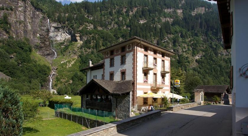
Hotels near Adula massif
Hotels to stay near Adula massif


Know more about Adula massif
Adula massif
Via Adula, 6710 Biasca, Switzerland
The Adula is a massif in the Lepontine Alps between the Saint-Gothard pass and the Splügen pass, mainly located in the cantons of Grisons and Ticino, but also in Lombardy. Its highest point is the Rheinwaldhorn, the highest peak in Ticino.