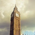
Midlothian - 43 Attractions You Must Visit
Contents in This Page
About Midlothian
Midlothian is a historic county, registration county, lieutenancy area and one of 32 council areas of Scotland used for local government. Midlothian lies in the east-central Lowlands, bordering the City of Edinburgh, East Lothian and the Scottish Borders.Types of Attractions in Midlothian


Popular Activities And Trips in Midlothian
Filter By Date
//
Sort By
List of Attractions in Midlothian
Allermuir AvenueA majestic hill, that is 493 metres high in the Pentland Hills region or range in Scotland It is one of the most impressive and most often noticed hills in the range. You can climb Allermuir Hill from a number of different starting points. A path from Hillend near Lothianburn leads up over neighbouring Caerketton Hill after climbing above the Midlothian Snowsports Centre, en route to Allermuir Hill.
1 Day Treks
Mountain Peaks
Arniston HouseA vast greenish 6000 acre esstate which offers accomodation, hosts special events, weddings and tours, surrounded by beautiful gardens and forestry. It has been home to the Dundas family for over 400 years. The house is of three storeys over a basement. The most significant interiors are William Adam's two-storey, galleried saloon, with decorative plasterwork by Joseph Enzer, and the Rococo dining room and drawing room, by the Adam brothers.
Outdoors - Other
Iconic Buildings
Baddinsgill ReservoirBaddinsgill Reservoir is a small reservoir close to Carlops. The reservoir occupies about 23.7 hectares. The Lyne Water is dammed to form the reservoir, not the Baddinsgill Burn, which joins the Lyne Water further south, below the reservoir. It is close to Baddinsgill House.
Lake/ River/ Ponds
Bavelaw CastleA majestic historic house in the City of Edinburgh council area, Scotland. Comprising two storeys, an attic and a basement, the original tower was probably the work of the Dundas family, and both Mary, Queen of Scots , and King James VI stayed here. It was now a historic monument and it attracts a lot of tourists.
Iconic Buildings
Old Ruins
Bell's HillBell Hill is one of the highest hills in the county of Dorset, England and a high point on the Wessex Ridgeway. The summit itself lies on a ridge running from northeast to southwest. There is evidence of prehistoric settlement, with a tumulus 500 metres southwest of the summit, a cross dyke beyond it and a settlement and field system in the area of the Ringmoor plantation. An iconic location for a picnic and also there are so many options in this area.
1 Day Treks
Mountain Peaks
Blackhope ScarBlackhope Scar is a majestic summit in the Moorfoot Hills region or range in Scotland. Blackhope Scar is 651 metres high. A rough, boggy moorland hill, it is usually climbed from the Gladhouse Reservoir and offers fine views from its summit. A good trekking destination and also it offers nice views of this area.
1 Day Treks
Mountain Peaks
Carnethy HillA majestic summit with a 73 metres high located in the Pentland Hills region or range in Scotland. A good trekking destination and also there are so many beautiful views from here. Loganlea Reservoir lies on the Northwest flank of the hill.
1 Day Treks
Mountain Peaks
Castlelaw HillA majestic hill that rises steeply from the valley to the northern tops of the Pentland Hills in Midlothian, Scotland. There was a majestic hill fort called,Castlelaw Hill Fort, which is an elaborate Iron Age fortification consisting of three earthwork ditches and banks protecting a roughly circular inner area.
1 Day Treks
Mountain Peaks
Castlelaw Hill FortThis is the remnant of a stronghold of the Iron Age, which has commands views over the Forth and Lothian. When it was occupied the site consisted of three earthwork ramparts, ditches and timber palisades. The fort contained a Souterrain for the storage of agricultural produce. An iconic attraction in this area and it attracts a lot of tourists.
Mountain Peaks
Forts
Old Ruins
Cauldstane SlapCauldstane Slap is a pass located in the Pentland Hills of Scotland. It marks the border between the neighboring council areas of West Lothian and Scottish Borders and historically the border between Edinburghshire and Peeblesshire. It offers a good trip through the middle of nature and also there are somnay other adventure options too.
Mountain Passes
Clubbiedean ReservoirClubbiedean reservoir is situated a mile south of Colinton. It is one of the smaller reservoirs in the hills, managed by Clubbiedean Fishery, offering day permits for boats and bank fishing for rainbow and blue trout. A good location for a picnic and there are so many other adventure options too.
Lake/ River/ Ponds
Crichton CastleA large majestic castle with a spectacular facade of faceted stonework in an Italian style which gives beauty to the castle. Constructed as a tower house in the late 14th century, and it was expanded as power of the Crichton family grew. However, the Crichtons fell from favour in the later 15th century, and the castle passed to the Earls of Bothwell. It was now in the care of Historic Environment Scotland, and are open to the public.
Iconic Buildings
East Cairn HillA majestic hill which was located in the Pentland Hills range of Scotland. With a height of 567 m. A good trekking destination and also there are so many things to see and do here.
1 Day Treks
Mountain Peaks
Glencorse ReservoirA beautiful reservoir which was located in Midlothian, Scotland, UK, two miles west of Glencorse, in the Pentland Hills. The reservoir is not the primary source of drinking water for Edinburgh, but instead provides a top-up supply when the principal supply from the Megget Reservoir and Talla Reservoir are low. It is also one of the iconic picnic places in this area.
Lake/ River/ Ponds
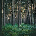
Glentress ForestThe gateway to the Tweed Valley Forest Park and home of a mountain biking centre which is one of the 7stanes mountain bike trails operated throughout southern Scotland by Forestry and Land Scotland. There are so many walking routes and options for tree-top adventure and magnificent views of the Tweed Valley.
Forests
Map
Comments
Please Sign In to add your comments
For more information about Midlothian, visit : https://en.wikipedia.org/wiki/Midlothian
This site is protected by reCAPTCHA and the Google Privacy Policy and Terms of Service apply