18 Attractions to Explore Near Piz Buin
Top Activities Near Piz Buin
Filter By Date
//
Sort By

Attractions & Activities Near You
Checkout attractions and activities near your current locationAll attractions near Piz Buin
DreiländerspitzeThe Dreiländerspitze is 3197 m above sea level. A. the highest mountain in the Dreiländerspitzgruppe in the Silvretta , a mountain range in the central eastern Alps. It is a favourite viewpoint, due to its position and accessibility. A good trekking destination too.
Silvretta StauseeThe Silvretta reservoir is located in the Austrian Alps in the state of Vorarlberg in the Silvretta group. Situated at the highest point of the Silvretta High-Alpine Road, the Silvretta reservoir is one of the most impressive artificial lakes of the Tyrolean Alps. Open to the public since 1954, it is one of the region’s most popular attractions. It features three dams and is used to generate electricity for the surrounding region.
Bielerhöhe PassA high mountain pass at an elevation of 2.071m above the sea level, located in the Austrian Alps between the Bundesländer of Vorarlberg and Tyrol. The pass connects Montafon and the Paznaun valley. The pass is traversed by the Silvretta Hochalpenstraße High Alpine Road. Due to its exposed location the road is closed to normal traffic in winter at which time it can be reached only by cable car from Partenen.
Silvretta-BielerhöheA paradise for friends of nature and the fascinating mountain world. It connects Vorarlberg with the Paznauntal in Tyrol and offers diverse recreational opportunities in the summer and winter alike. At 2,032 m above sea level, it opens you up to completely new perspectives.
VermuntseeThe Vermuntsee is located at the end of the Montafon valley , in the Austrian state of Vorarlberg , at an altitude of 1743 m above sea level. A. It is bounded in the south by the glaciated Litzner - Seehorn group, in the east by the mountain range of the Kresperspitze and in the west by the Hochmaderer .
Castle of TaraspTarasp Castle is a castle in Switzerland, near the former municipality of Tarasp (now Scuol), in Lower Engadin, Graubünden. It is a Swiss heritage site of national significance. It was one of the main historical attrition in this area and also a worth visit place. From here we an understand the Swiss architecture's intelligence.
Stausee KopsThe Kops reservoir is located in the Austrian Alps in the state of Vorarlberg on the border between Silvretta and Verwall . It has a usable capacity of 42.9 million cubic meters , which corresponds to an energy content of 127.45 million kilowatt hours. The Kops reservoir can be reached on foot or by bike through the Ganifer via an extremely steep, narrow road from Partenen in Montafon , which is closed to general vehicle traffic .
WiegenseeThe Wiegensee is located northeast of the district of Partenen in the Austrian state of Vorarlberg in the municipality of Gaschurn . At the foot of the Versalspitze , at an altitude of 1925 m above sea level. A. located, the lake can only be reached on foot.The nutrient-poor moor lake is situated within the 65 hectares large FFH - area Wiegensee.
Flüela PassFlüela Pass is a high mountain pass in the Swiss Alps in the canton of Graubünden. The road connects Davos and Susch in the lower Engadin valley. Since the Vereina Tunnel opened in 1999, the road is no longer guaranteed to be open all year. An NGO, Pro Flüela Verein, was established in 1990 to extend the opening outside the summer months. It raises money from membership fees, and grants from the cantonal government and local communes.
Versettlabahn BergstationThe Versettlabahn is a 1986-built gondola the Austrian state of Vorarlberg. The two-part lift takes a maximum of six people per cabin from the valley station in Gaschurn in the Montafon via the middle station 1480 m above sea level. A. to the mountain station on the slope of the Versettla at an altitude of 2010 meters. The maximum speed is 18 km / h, the greatest inclines are 69 percent in the first and 94 percent in the second section.
Lake DavosLake Davos is a small natural lake at Davos, Switzerland. Its surface area is 0.59 km² and the maximum depth is 54 m. Fed by sources of the Rhine, Flüelabach and Totalpbach, among other mountain creeks, the lake is used as a hydropower reservoir; its water no longer flows to the river Landwasser but is channeled into the river Landquart at Klosters.
Val d’UinaThe Val d'Uina is a small side valley of the Lower Engadine between the Piz S-chalambert in the north-east and Piz Lischana in the south-west. The Uina flows through it and flows into the Inn Valley at Sur En . In the valley lie the two hamlets of Uina Dadaint and Uina Dadora, which have been inhabited all year round for centuries and are now only cultivated in summer. In Uina Dadaint, a house and a stable with barn are still preserved. In Uina Dadora, at 1499 m, the Val Curtinatsch, the large
Swiss National ParkThe Swiss National Park stretches over 170 square kilometre and is Switzerland’s largest nature reserve. The area lies in Engadin/Münstertal and encompasses alpine terrain rising from 1’400 to 3’200 m above sea level. The foundation of the Swiss National Park in 1914 was a milestone in the history of nature conservation. It was the first national park in the Alps and Central Europe, it is known for its abundance of Alpine animals and Alpine plants in a barely touched pristine landscape.
GotschnagratA beautiful and high mountain located in the canton of Graubünden which was the part of Plessur alps. There is a cable car to reach the summit of this mountain. From this cable car, we can enjoy the beauty and the wilderness of this mountain. This place is efficient for trekking and rock climbing too.
ParsennParsenn is a ski area near Davos, Switzerland, offering 35 ski runs. The Parsenn area is the largest and most modern of Davos' five mountains. The recently updated Parsenn "red railway" funicular covers the difference of 1,100 metres up to the Weissfluhjoch ridge. One can also get from Klosters to Gotschna/Parsenn with a large cable car which runs from here run up to 17 kilometres into the Prättigau valley.
MadrisaThe Madrisa is a mountain in the Rätikon mountain range, overlooking Klosters in the Swiss canton of Graubünden. Its summit is located near the Austrian border. The Madrisa is constituted by several secondary summits, notably the Gargeller Madrisa, overlooking Gargellen in Austria. Ski lifts up to 2,600 metres are located on the Klosters side.
Kirchner Museum DavosThe Kirchner Museum Davos offers visitors an extraordinary opportunity to experience works of Ernst Ludwig Kirchner in the very place they were created. The Kirchner Museum continually presents varied ensembles of key works from its extensive collection. In addition, it stages temporary exhibitions that highlight either particular aspects of the work of Kirchner and other major artists of the classical Modern period or currents in contemporary art.
WeissfluhjochThe Weissfluhjoch is 2693 m above sea level. M. high mountain in the plural Alps in Switzerland. It is located in the north-west of Davos in the triangle of the Landwassertal, Prättigau and Schanfigg regions and is the local mountain of the Alpine city. The Parsennbahn has been opening up the Weissfluhjoch for tourism since 1932.
Map of attractions near Piz Buin
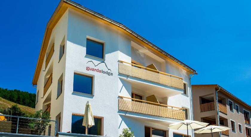
Top hotels near Piz Buin

Know more about Piz Buin
Piz BuinA beautiful mountain located in the borders of Austria and Switzerland which was part of the Silvretta range of the Alps. A nice trekking destination. Trekking will be difficult in the winter season because of the snow covering. The view of the mountain is truly breathtaking and also you can enjoy the beauty of this area from the top of the mountain.