18 Attractions to Explore Near Hunt Lake Trail
Top Activities Near Hunt Lake Trail
Filter By Date
//
Sort By

Attractions & Activities Near You
Checkout attractions and activities near your current locationAll attractions near Hunt Lake Trail
North Fork ReservoirNorth Fork Reservoir is a reservoir behind North Fork Dam, on the Clackamas River, upriver from Estacada. It is found at an elevation of 666 feet. It is a popular fishing area and it is near Portland, Oregon, is easily accessible, and is a popular recreation area. It is also a popular boating area.
Monarch MountainMonarch Mountain is one of the oldest Colorado ski areas, which opened in 1939. It’s located in the central Rocky Mountains near Salida and receives over 350 inches of snow each year. The resort is situated on Monarch Pass at the continental divide. It has 54 trails, two terrain parks, and an extreme terrain area called Mirkwood. The Monarch Mountain Lodge is located three miles (5 km) east of the ski area in the town of Garfield, Colorado.
Billings LakeBillings Lake is a 97.4 acre natural water body with a concrete dam, which raises the water level by 10 feet. A number of houses have been built on the western side of the lake, and most of them are occupied only during the summer months. The rest of the lakeshore is forested, with the exception of a camp on the northeastern side.
Tomichi PassTomichi Pass is a high mountain pass in the Sawatch Range of the Rocky Mountains of Colorado. It is located in Gunnison County and in the Gunnison National Forest. The pass divides the watersheds of Middle Quartz Creek to the north and Tomichi Creek to the south.The pass was originally traversed by a pack trail connecting the mines and mining camps to the north with those to the south in the 1870s.
Monarch PassMonarch Pass is one of the most breathtaking and fun to visit high elevation mountain passes in Colorado. The pass carries U.S. Highway 50 over the Sawatch Range, providing a route between Tomichi Creek in the upper basin of the Gunnison River on the west and the South Arkansas River, a tributary of the Arkansas River, on the east. The pass is widely considered one of the most scenic in Colorado, offering a panoramic view of the southern end of the Sawatch Range from the summit.
Hancock PassHancock Pass is a high mountain pass at an elevation of 3.702m, located on the boundary between Chaffee and Gunnison counties, in western Colorado. The pass is on the border between Chaffee and Gunnison counties and between the Gunnison and San Isabel national forests. The road to the summit is totally unpaved. It's called Forest Road 839 and Forest Road 299. It’s moderate difficulty and is very rocky and slow going.
Tabeguache PeakTabeguache Peak is the 26th highest peak in Colorado. It is one of the lesser known of the Colorado 14ers. It is a near neighbor of the higher peak Mount Shavano, which lies approximately 1/2 mile to the southeast, and is close to being a subpeak of the latter. Tabeguache Peak is often climbed in conjunction with Mount Shavano. Previously, Tabeguache seemed a more significant mountain because the bulk of this route to both peaks took place on its slopes.
Mount ShavanoMount Shavano is a high mountain summit in the southern Sawatch Range of the Rocky Mountains of North America. It is famous for the Angel of Shavano, a snow formation in the image of an angel that emerges on the east face of the mountain during snow melt each spring. A good trekking destination and also it offers breathtaking views of this area.
Cronin PeakCronin Peak is Colorado's 75th highest summit. It is a gently sloped, reddish mountain in the Sawatch Range. it is one of the iconic trekking destination and also there are so many things to see and do here.
Alpine Tunnel Alpine Tunnel is a 1,772 ft narrow gauge railroad tunnel located east of Pitkin, Colorado on the former Denver, South Park and Pacific Railroad route from Denver to Gunnison. It was a 1,772 feet long tunnel built for a narrow gauge rail line that ran from Denver to Gunnison. It opened in 1882, and was the first tunnel crossing of the Continental Divide in the state.
Greens Creek Hiking TrailThis is a 7-mile trail to the Continental Divide or 6 miles to the Green’s Creek Crossing. The lower section of the trail is smooth and winds through tight aspen trees. The upper section is steep, wet, and rocky. The trail is used by hikers, horseback riders, bikers and motorized dirt bikes.
Mount AnteroMount Antero is the highest Colorado mountain named after a native American Indian. It is primarily known to have the highest gem field and high concentrations of aquamarine within the conterminous United States. There are several active private mining claims being exploited on Mount Antero and surrounding peaks. There are two popular climbing routes on Mount Antero.
Mount OurayMount Ouray is a mountain peak in Saguache County. With an elevation of 12,943 feet, it is the county's highest point. The mountain is located in the San Juan Mountains, a range of the Rocky Mountains. Mount Ouray is named for Chief Ouray of the Ute tribe, who lived in the area. The mountain has been a popular destination for hikers and climbers since the late 19th century. A trail to the summit was built in 1887, making it one of the first mountains in Colorado to be accessible by trail.
Chalk LakeChalk Lake is a beautiful lake lcoated in the heart of Chaffee and is famous for fishing too. It is a very popular campground with an array of recreational opportunities like hiking, mountain biking and off-road vehicle riding.
Chalk CreekChalk Creek is a 27.3-mile-long river flowing east from the Collegiate Peaks mountain range in Chaffee County. The river is surrounded by a mix of privately owned and US forest service land. Campgrounds and public trails, including the Colorado Trail, are located along the length of the river. Several hot springs emerge in this valley.The river is named after the magnificent white kaolinite cliffs that stand at the entrance to the Chalk Creek valley, and are a result of hot spring deposits.
Cascade CanyonCascade Canyon is located in Grand Teton National Park, in the U.S. state of Wyoming. It has numerous polished glacial erratics, hanging cirques and a U-shape as evidences that demonstrate that glaciers once filled the canyon to a depth of at least 2,000 feet. Cascade Creek now flows where the glaciers once did and the numerous waterfalls, such as the 100-foot tall Hidden Falls, found within the gorge are popular destinations with tourists.
Agnes Vaille WaterfallAgnes Vaille Falls is nestled in the mountainside of Chalk Creek Canyon, south of Buena Vista. It requires a short, uphill hike to the falls.This trail is, however, still being taken today, as there are no officials signs stating it is still closed. Social media shows much activity on the once closed trail.
Napoleon PassNapoleon Pass is a high mountain pass in the Sawatch Range of the Rocky Mountains of Colorado. The pass is the saddle between Napoleon Mountain to the west and Fitzpatrick Peak to the east and divides the watersheds of Middle Willow Creek to the north and Quartz Creek to the south. Napoleon Pass is traversed by Forest Trail 540 and can be accessed from the towns of Tincup to the north and Pitkin to the south.
Map of attractions near Hunt Lake Trail
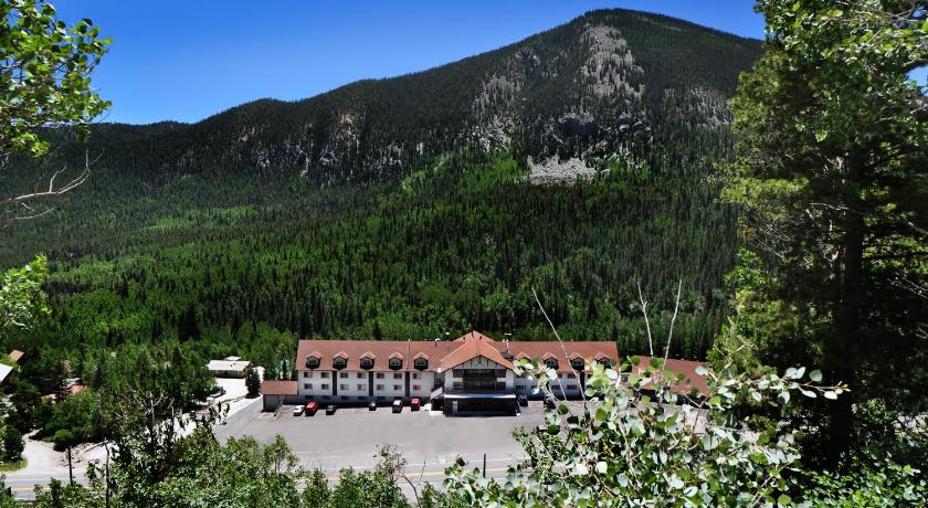
Top hotels near Hunt Lake Trail
5 Reviews
6.6
$111.61 per nightSelect
Know more about Hunt Lake Trail
Hunt Lake TrailHunt Lake Trail is a short hike below the Continental Divide north of the summit of Monarch Pass and east of Salida, Colorado. The trail is fairly steep in places and moves over rocky, rough terrain. Hiking poles are a good idea to provide yourself with extra stability. Ensure that you have proper footwear that offer good stability for this rough granite trail with has lots of ups and downs.