Hunt Lake Trail - 4 Things to Know Before Visiting
Lake/ River/ Ponds
Things to know
About Hunt Lake Trail
Hunt Lake Trail is a short hike below the Continental Divide north of the summit of Monarch Pass and east of Salida, Colorado. The trail is fairly steep in places and moves over rocky, rough terrain. Hiking poles are a good idea to provide yourself with extra stability. Ensure that you have proper footwear that offer good stability for this rough granite trail with has lots of ups and downs.Address : Forest Rd 230, Salida, CO 81201, USA
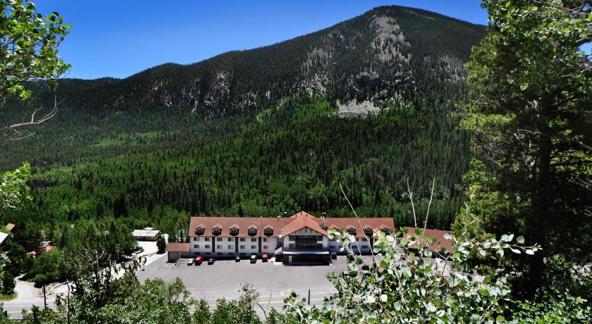
Hotels near Hunt Lake Trail
5 Reviews
6.6
$111.61 per nightSelect
Top Activities Near Hunt Lake Trail
Filter By Date
//
Sort By
Attractions Near Hunt Lake Trail
North Fork ReservoirNorth Fork Reservoir is a reservoir behind North Fork Dam, on the Clackamas River, upriver from Estacada. It is found at an elevation of 666 feet. It is a popular fishing area and it is near Portland, Oregon, is easily accessible, and is a popular recreation area. It is also a popular boating area.
Monarch MountainMonarch Mountain is one of the oldest Colorado ski areas, which opened in 1939. It’s located in the central Rocky Mountains near Salida and receives over 350 inches of snow each year. The resort is situated on Monarch Pass at the continental divide. It has 54 trails, two terrain parks, and an extreme terrain area called Mirkwood. The Monarch Mountain Lodge is located three miles (5 km) east of the ski area in the town of Garfield, Colorado.
Billings LakeBillings Lake is a 97.4 acre natural water body with a concrete dam, which raises the water level by 10 feet. A number of houses have been built on the western side of the lake, and most of them are occupied only during the summer months. The rest of the lakeshore is forested, with the exception of a camp on the northeastern side.
Tomichi PassTomichi Pass is a high mountain pass in the Sawatch Range of the Rocky Mountains of Colorado. It is located in Gunnison County and in the Gunnison National Forest. The pass divides the watersheds of Middle Quartz Creek to the north and Tomichi Creek to the south.The pass was originally traversed by a pack trail connecting the mines and mining camps to the north with those to the south in the 1870s.
Monarch PassMonarch Pass is one of the most breathtaking and fun to visit high elevation mountain passes in Colorado. The pass carries U.S. Highway 50 over the Sawatch Range, providing a route between Tomichi Creek in the upper basin of the Gunnison River on the west and the South Arkansas River, a tributary of the Arkansas River, on the east. The pass is widely considered one of the most scenic in Colorado, offering a panoramic view of the southern end of the Sawatch Range from the summit.
Hancock PassHancock Pass is a high mountain pass at an elevation of 3.702m, located on the boundary between Chaffee and Gunnison counties, in western Colorado. The pass is on the border between Chaffee and Gunnison counties and between the Gunnison and San Isabel national forests. The road to the summit is totally unpaved. It's called Forest Road 839 and Forest Road 299. It’s moderate difficulty and is very rocky and slow going.
Discover More Attractions in Chaffee County, Home of Hunt Lake Trail
Chaffee CountyChaffee County is one of the 64 counties in the U.S. state of Colorado. It is home to Buena Vista, Salida & Poncha Springs Colorado. 14,000-foot peaks to the west and the Arkansas River to the east make these communities unique. Create your own adventure and enjoy all that Colorado outdoors has to.
Location of Hunt Lake Trail
Comments
Please Sign In to add your comments
For more information about Hunt Lake Trail, visit : https://www.alltrails.com/trail/canada/manitoba/hunt-lake-trail
Looking for hotels nearby. Click here to explore!
This site is protected by reCAPTCHA and the Google Privacy Policy and Terms of Service apply