Graham County - 27 Attractions You Must Visit
Contents in This Page
About Graham County
Graham County is a county in the southeastern part of the U.S. state. Today, the area's natural wonders attract city dwellers seeking adventure and relaxation - backpacking through Aravaipa Canyon Wilderness, hiking alongside Bonita Creek, floating down the Gila River, fishing on Roper Lake, or relaxing in natural mineral hot springs.Types of Attractions in Graham County


Popular Activities And Trips in Graham County
Filter By Date
//
Sort By
List of Attractions in Graham County
Ash Creek FallsAsh Creek Falls is one of the finest falls in California. It is set far back in Ash Creek Canyon as the waterfall makes a huge scene, gushing over the cliff in a strong freefall. The water hits a rocky area and creates a a big shower. The waterfall is 330 feet high and is a combination of Mud Creek Falls and Whitney Falls. It does not have as much volume as Mud Creek Falls, but it has plenty of power.
Waterfalls
Black Hills Rockhound AreaBlack Hills rockhound area is located on the north side of Arizona route 191, between Safford and Clifton, about 18 miles north of Safford.This rockhound area makes a great day adventure for rock collectors. The principal attraction for rock collectors here is fire agate. Fire agate is a relatively new gemstone, only identified and formally recognized in the 1930s. It has the color play of precious opal with gem quality reds, greens, and blues.
1 Day Treks
Mountain Peaks
Blue Jay PeakBlue Jay Peak is the western-most peak in the Pinaleño Mountain of Graham County. However, it is separated from the main range by a low pass, enough to give Blue Jay Peak nearly 1,700 feet of prominence and the appearance of being its own singular mountain. It is one of the iconic attraction in this area and also there are so many things to see and do.
1 Day Treks
Mountain Peaks
Cluff Ranch PondsThe Cluff Ranch Ponds are located in the Cluff Ranch Wildlife Area at the base of the Pinaleno Mountains in southeastern Arizona. The town of Pima is 5 miles away, and the city of Safford is 7 miles away. The facilities are maintained by the Arizona Game and Fish Department.
Lake/ River/ Ponds
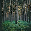
Coronado National ForestThe Coronado National Forest is a United States National Forest that includes an area of about 1.78 million acres spread throughout mountain ranges in southeastern Arizona and southwestern New Mexico. The national forest is divided into five ranger districts, which are not contiguous; each consists of multiple sky island mountain ranges.
Forests
Dankworth PondDankworth Pond is 150 acres of land surrounding a 15-acre pond. The park was once a fish hatchery for raising catfish. It has picnic ramadas, trails, and so more.
Lake/ River/ Ponds
Parks
Frye Mesa ReservoirFrye Mesa Reservoir is an excellent place to camp out for a night or spend a day escaping the southern Arizona heat. This Reservoir contains both Apache and Gila trout, making it one of the only places to legally catch Gila trout in Arizona. Frye Mesa offers spectacular views of the Gila River Valley below and the rocky peak above.
Lake/ River/ Ponds
Galiuro WildernessThe 76,317-acre Galiuro Wilderness encompasses the mid to upper slopes of the mountains as they rise from golden grasslands, through dense thickets of evergreen oak, to stands of ponderosa pine. The mountains support vegetation varying from semidesert grasslands through pinion, juniper, oak, and brush to mixed conifers and even aspens in the higher elevations. A variety of wildlife can be found in the Galiuro Wilderness, including large mammals.
Outdoors - Other
1 Day Treks
Forests
Gila BoxThe 23,000-acre Gila Box Riparian National Conservation Area includes four perennial waterways, the Gila and San Francisco rivers and Bonita and Eagle creeks. This region is a very special riparian ecosystem abounding with plant and animal diversity. Impressive Gila Conglomerate cliffs tower more than 1,000 feet above the Gila River, and bighorn sheep are commonly spotted. Bonita Creek, a key tributary of the Gila River, is lined with large cottonwoods, sycamores, and willows.
Outdoors - Other
Gila Box Riparian National Conservation AreaGila Box Riparian National Conservation Area is a National Conservation Area located along the Gila River in southern Graham and Greenlee counties in southeastern Arizona in the United States. Administered by the Bureau of Land Management, the conservation area is approximately 23,000 acres in size. Campgrounds and hiking trails are available. The section of the Gila River that flows through the Gila Box is popular with white-water rafters and kayakers.
Outdoors - Other
Heliograph PeakHeliograph Peak is a subsidiary summit of Mount Graham in the Pinaleño Mountains. There is a good forest road to the top, and the peak is probably the best in the range for summit views, given that Mount Graham itself is off-limits and wooded, and the other high peaks are usually wooded too.
1 Day Treks
Mountain Peaks
Hot Well DunesHot Well Dunes provides the opportunity to ride 2,000 acres of sand dunes, set up a camp, and then soak in relaxing hot tubs, all in the same location.The sands at the Hot Well Dunes Recreation Area were a beach surrounding a lake approximately two million years ago. What remains today is one of the most unique recreation spots in Arizona.
Dunes
Ladybug PeakLadybug Peak is a mountain in the Sierra Nevada in United States. This is a popular trail for hiking, mountain biking, and snowshoeing, but you can still enjoy some solitude during quieter times of day. There are so many things to see and do here.
1 Day Treks
Mountain Peaks
Lake TakalaiLake Takalai is a reservoir in Arizona and has an elevation of 817 metres. It is situated nearby to Elgo Dam, and northeast of Sevenmile Wash. It is one of the iconic attraction in this area and also there are so many things to see and do.
Lake/ River/ Ponds
Mount GrahamMount Graham is the highest of the peaks that breach the 10,000-foot barrier, while nearby Hawk Peak is home to the Mount Graham Observatory, its buildings visible from below and even from vantage points on distant peaks. It is the highest elevation in Graham County, Coronado National Forest and the Pinaleño Mountains. It is also the southernmost peak and land area in the continental United States above 10,000 feet. A good trekking destination and also there are so many things to do.
1 Day Treks
Mountain Peaks
Mount Graham International ObservatoryThis is the research arm for the Department of Astronomy at The University of Arizona. MGIO consists of three telescopes: the Vatican Advanced Technology Telescope, the Heinrich Hertz Submillimeter (Radio) Telescope of the Arizona Radio Observatory, and the Large Binocular Telescope, the world's most powerful telescope. Public tours of the MGIO are conducted by the Eastern Arizona College's (EAC) Discovery Park Campus between mid-April and mid-October.
Planetariums
Mount TurnbullMount Turnbull is the highest point in the Santa Teresa Mountains in western Graham County, Arizona. The summit has an elevation of 8,284 feet and a prominence of 3,562 feet. It is the highest point in the Santa Teresa Mountains and the San Carlos Apache Indian Reservation. A recreational permit is required for access to reservation land.
1 Day Treks
Mountain Peaks
Point of Pines The Point of Pines Sites are a set of archaeological sites on the San Carlos Apache Indian Reservation in the U.S. state of Arizona. Located around the settlement of Point of Pines, they are significant for associations with Ancestral Pueblo, Mogollon and Hohokam cultures. The sites were chosen as a field school location by Dr. Emil Haury because of the unusual presence of all three major prehistoric cultures of Arizona.
Outdoors - Other
Map
Comments
Please Sign In to add your comments
For more information about Graham County, visit : https://en.wikipedia.org/wiki/Graham_County,_Arizona
This site is protected by reCAPTCHA and the Google Privacy Policy and Terms of Service apply