18 Attractions to Explore Near Lac de Serre-Ponçon
Top Activities Near Lac de Serre-Ponçon
Filter By Date
//
Sort By

Attractions & Activities Near You
Checkout attractions and activities near your current locationAll attractions near Lac de Serre-Ponçon
Écrins National ParkÉcrins National Park is one of the ten French national parks. It is located in the south-eastern part of France in the Dauphiné Alps south of Grenoble and north of Gap, shared between the départements of Isère and Hautes-Alpes. It rises up to 4,102 m at the Barre des Ecrins and covers 918 km2 of high mountain areas, with high peaks, glacier fields, glacier valleys, alpine pastures, subalpine woodlands, and lakes. One of the nice trekking destination and also rock climbing is possible here.
Col de la BonetteCol de la Bonette is a mountain pass and the highest asphalt road in Europe, situated within the Mercantour National Park of the French Alps. The mountain pass offers many beautiful viewpoints.
Col d'IzoardCol d'Izoard is a mountain pass that connects Briançon and the Guil valley in the French Alps. Near the summit, there is a monument remembering the epic battles between Fausto Coppi and Louison Bobet in 1950.
Serre ChevalierSerre Chevalier is one of the beautiful ski resorts in Franc Located near Écrins National Park. The resort includesa large skiing area, with 250 km of slopes.
Lago NeroLago Nero is a beautiful lake in the Province of Bergamo, Lombardy, Italy. At an elevation of 2014 m, its surface area is 0.16 km². It is one of the main water source of this area and also a tourist attraction too.
MeijeLa Meije is a mountain overlooking the village of La Grave located in the Massif des Écrins range. The mountain is well-known for its off-piste and intense skiing opportunities.
Valle VaraitaThe Varaita Valley is a valley in the Province of Cuneo, in Piedmont, whose symbol is the Monviso and with it, mountain lakes, ancient villages, ski slopes, and the presence of the Bosco dell'Alevé, which make it a popular tourist destination. One of the nice trekking destination and also the views from here is truly breathtaking.
Les Deux AlpesLes Deux Alpes is a ski resort in the French department of Isère, Auvergne-Rhône-Alpes. The village sits at 1,650 m and lifts run to 3,600 m. It has the largest skiable glacier in Europe and is France's second oldest ski resort behind Chamonix, where the largest mountain in western Europe is located, Mont Blanc. It has the longest, normally open full on-piste vertical available in the world. It is a 71 km drive southeast of Grenoble.
Monte VisoMonte Viso is the mountain highest of the Hautes Alpes and ' eponymous mountain range, including the subsection of the Monviso Alps, in Piedmont. Also known because at its foot there is the source of the river Po, the longest watercourse in Italy, since 29 May 2013 it has become a UNESCO heritage site as a cross-border biosphere reserve with France, and since 2016 it has been part of the Monviso Natural Park on the Italian sector, while the Queyras Natural Park insists on the French one.
Col du GalibierThe Col du Galibier is a mountain pass in the southern region of the French Dauphiné Alps near Grenoble. It is the eighth-highest paved road in the Alps, and recurrently the highest point of the Tour de France. It connects Saint-Michel-de-Maurienne and Briançon via the col du Télégraphe and the Col du Lautaret. The pass is closed during the winter. It is located between the massif d'Arvan-Villards and the massif des Ceres, taking its name from the secondary chain of mountains known as the Galib
Via LatteaThe Via Lattea consists of two parallel valleys just west of Turin that offer top-notch skiing facilities. The valleys hosted many events at the 2006 Winter Olympics, and the facilities and infrastructure remain state of the art. it comprises the five Piedmontese resorts and additionally the French resort Montgenèvre. Altogether there is more than 400 km (250 miles) of skiable pistes,120 of them with artificial snow, and 70 lifts.
Mercantour National ParkMercantour National Park is a French national park with an area of protected land that covers around 685-kilometer square. The park includes beautiful lakes, diverse wildlife, many valleys, and villages. There is a lot of footpaths through villages which gives a varied experience to visitors.
L'Alpe d'HuezAlpe d'Huez is one of Europe's premier skiing venues, having gained popularity when it hosted the bobsled events of the 1968 Winter Olympics. With 249 km of piste and 84 ski lifts, the resort is now one of the world's largest. Extensive snowmaking facilities helped combat the ski area's largely south-facing orientation and helped Alpe d'Huez appeal to beginner skiers, with very easy slopes. There are also good intermediate-grade slopes, but the resort is mostly known for freeskiing.
ISOLA 2000Isola 2000 is a ski resort in the southern French Alps. It is located next to the Mercantour National Park and is about 90 km from Nice, France. It offers skiers and riders 45 alpine ski slopes and an incredible panorama from the massif of the Ecrins.
ChamrousseChamrousse is a ski resort in southeastern France, located in the mountains above Grenoble at the summit of the Belledonne range. It offers so many outdoor activities, including hiking, mountain biking, tennis, archery, climbing, horse riding, fishing, quad biking, and paragliding also. It is located in a commune of the same name and is situated on the Recoin at 1,650 m and the Roche Béranger at 1,750 m. The ski-lifts reach the Cross of Chamrousse at 2,253 m.
Colle SommeillerThe Colle del Sommeiller is an alpine pass of the Cottian Alp, located along the border line between Italy and France, between Punta Sommeiller and Rognosa d'Etiache , connecting the city of Bardonecchia with the municipality of Bramans , in the French department of Savoy. During the short period of practicability of the entire road on the Italian side, the international motorcycle meeting Raid Stella Alpina is organized every year on the second Sunday of July, starting from Bardonecchia and arr
FenestrelleThe fort of Fenestrelle is Europe’s biggest fortified structure and the largest walled construction after the Great Wall of China. A stone colossus that extends for about five kilometers along the hills of the Val Chisone and covers a height difference of almost 700 meters. Fenestrelle Fortress was intended to serve as an impenetrable barrier for Italy in the eighteenth century. It is now one of the major attractions in this area which attracts a lot of tourists.
Val ChisoneThe Val Chisone is one of the Occitan valleys of western Piedmont, situated in the Cottian Alps of north-west Italy. Traditionally, the valley's entrances are considered the towns of Pinerolo and Sestriere. It is bounded by the Val di Susa to the north and east, the Val Sanguine to the north, the Val Pellice to the south, while eastwards is the plain of the Po Valley. The valley is crossed by the torrent from which it takes its name, the Chisone. The valley has a main branch, the Valle Germanasc
Map of attractions near Lac de Serre-Ponçon
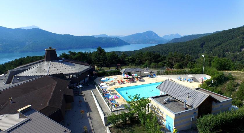
Top hotels near Lac de Serre-Ponçon
1 Reviews
8.4
$253.63 per nightSelect
Know more about Lac de Serre-Ponçon
Lac de Serre-PonçonLac de Serre-Ponçon is the second largest artificial lake in Europe with an area of 3,000 hectares.