Turracher Höhe Pass - 4 Things to Know Before Visiting
Mountain Passes
Things to know
About Turracher Höhe Pass
Turracher Höhe is a high mountain pass at an elevation of 1.795m above the sea level, located in the Gurktal Alps in Austria. The road to the pass has a maximum gradient of 23%. During the 20th century, the region was gradually developed for tourism. Efforts are being made to maintain the diversity of flora and fauna of the Turracherhöhe by means of landscape conservation areas and careful and nature-oriented extension of the tourist facilities.Address : Turracher Höhe Pass, 9565, Austria
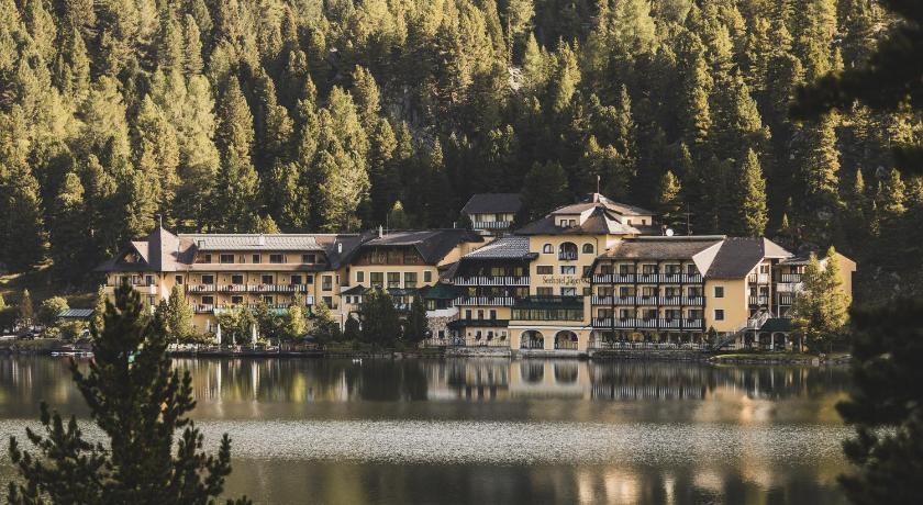
Hotels near Turracher Höhe Pass


Top Activities Near Turracher Höhe Pass
Filter By Date
//
Sort By
Attractions Near Turracher Höhe Pass
Nocky FlitzerThe Nocky Flitzer Alpine rollercoaster is a hit with both young and old. The 1.6 km course offers sharp curves through the Swiss stone pine forest, spirals, moguls and ramps.From the top station of the panoramic cable car you have a view of Lake Turrach, a panoramic views of the Karawanken Alps in the south and views through the Swiss stone pine forest down to the Turracher Höhe.
Nockberge Biosphere ReserveNockberge National Park was a national park in Upper Carinthia, Nockberge in Austria. It was established in 1987 and dissolved in 2012. In July 2012, it was converted into Salzburger Lungau und Kärntner Nockberge, a UNESCO designated biosphere reserve. Originally a ski area had been planned in what is now the core zone of the Nockberge since the early 1970s, when the region was opened up with the Tauern Autobahn.
HochrindlHochrindl is a mountain pass and alpine ski resort in the Austrian Alps located between Reichenau and Albeck. The pass was largely uninhabited and used as pasture land until the late 20th century when it became a location for summer and winter tourism.
NockalmstraßeThe Nockalmstraße is a toll road in Carinthia , Austria . It leads from Innerkrems over the Eisentalhöhe, Karlbad , Grundtal, Schiestelscharte and Winkltal to Ebene Reichenau. Over a length of 35 kilometers, the Nockalmstraße meanders over 52 hairpin bends between Innerkrems and Reichenau with a maximum gradient of 12% through the low mountain range. Before Ebene Reichenau the road joins the state road B 95 , the formerly steepest pass road in Europe.
Wöllaner NockThe Wöllaner Nock is a 2145 meter high peak in Carinthia , it is located in the municipality of Arriach and is its highest point. As part of the Nockberge, it lies between the region valley in the south and the Bad Kleinkirchheim valley in the north. The village of Afritz am See extends south of the summit and Bad Kleinkirchheim to the north.
Afritzer SeeThe Afritzer See is a lake in Carinthia . It is located in the region of the valley north of Villach in the municipality of Feld am See. It is located in the region valley in the Nock Mountains at an altitude of 752 m above sea level. The lake is the remnant of what was once a larger lake. This was divided by a rock fall from the Mirnock. Since the lake is located in an often windy valley furrow, it does not reach the high water temperatures of other Carinthian lakes.
Discover More Attractions in Carinthia, Home of Turracher Höhe Pass
Location of Turracher Höhe Pass
Comments
Please Sign In to add your comments
For more information about Turracher Höhe Pass, visit : https://en.wikipedia.org/wiki/Turracher_H%C3%B6he_Pass
Looking for hotels nearby. Click here to explore!
This site is protected by reCAPTCHA and the Google Privacy Policy and Terms of Service apply