18 Attractions to Explore Near Passo Fedaia
Top Activities Near Passo Fedaia
Filter By Date
//
Sort By

Attractions & Activities Near You
Checkout attractions and activities near your current locationAll attractions near Passo Fedaia
Fedaia LakeThe lake Fedaia is an alpine lake of the Fassa Dolomites , located just west of the Fedaia pass, under the mountain group of the Marmolada, in the municipality of Canazei, in the province of Trento. There are actually two lakes of Fedaia, separated from each other by an artificial dam called Controdiga di Maria al Lago. The best known and largest is the western one, which originated after the construction of a dam in 1956; the other, of natural origin, have considerably smaller dimensions and w
Passo FedaiaThe Fedaia pass is an alpine pass located on the border between Trentino-Alto Adige and Veneto, between the provinces of Trento and Belluno, which connects the Val di Fassa to Agordino, at the foot of the Marmolada, through the state road 641 of the Fedaia Pass. The pass is formed by a plateau of about 2.5 kilometers, near which there is an artificial lake, Lake Fedaia, used for the production of hydroelectric energy.
Marmolada GlacierLocated in the eastern Dolomites, the Marmolada Glacier is one of Italy's most popular tourist destinations. Surrounded by peaks that rise to over 9,000 feet, the glacier is a stunning sight. And with its many ski trails, it's also a great place to hit the slopes. The Marmolada Glacier is one of the largest glaciers in the Dolomites, and it's also one of the most easy to access.
MarmoladaThe Marmolada is a mountain group of the Eastern Alps on the border between the province of Trento and the province of Belluno, the highest of the Dolomites themselves, reaching the maximum altitude with Punta Penia, bounded to the east by the Val Pettorina and to the west by the Val di Fassa, with other important valleys inside the group that are Val Contrin , Val di Grepa, and Val San Nicolò. One of the nice trekking destinations and also a picturesque viewpoint.
Pordoi PassThe Pordoi Pass is an Alpine pass in the Dolomites located at 2,239 m asl, located between the Sella Group to the north and the Marmolada group to the south. From the Pass, you have the quickest access to the Sella group by means of the cable car. On the Venetian side of the pass, there is an ossuary that collects, in a common tomb, the remains of 454 Germanic fallen and of 8,128 Austro-Hungarian fallen during the Great War. The area around the step is home to numerous installations and ski sl
Piz BoèThe Piz Boe is a mountain of the Dolomites high 3,152 m, the highest peak of the Sella Group, on the border of the provinces of Belluno, Bolzano, and Trento. Piz Boè is one of the least difficult 3000 in the Dolomites as regards the technical difficulties and the difference in height: the cable car that starts from the Pordoi pass allows, in fact, to reach the 2,950 m altitude of Sass Pordoi in a few minutes. However, the access route is not unique: at least 4 can be counted with different degr
Sass PordoiSass Pordoi is a plateau-like rock summit which was located in the heart of Italy. It is accessible by cable car from the Passo Pordoi ridge. Also, a hiking tour proceeds up to the peak. The easiest route is the one from the south, the path proceeds beneath the cable car until the summit. There is a restaurant up there and a lookout platform, famous for its views towards the Marmolada and Langkofel Groups. The cable-car is free-hanging - there are no pillars on the 800m ascent.
Sella RondaSella Ronda is the most recognized ski route of the Dolomites. It is a loop that runs either clockwise or counterclockwise around the massif of the Sella mountain range. This route can easily be accomplished in one day. In winter it is possible to ski around the entire massif by using the Sellaronda ski lift carousel. The well-connected lifts and superbly prepared pistes will allow you uninterrupted skiing on almost 30 kms of ski runs in one single day.
Sella PassThe Sella pass is a mountain pass in the Dolomites, located at 2240 m above sea level, between the Sassolungo and the Sella Group. It connects Canazei, in Val di Fassa with Selva di Val Gardena, in Val Gardena. Itt is a popular tourist destination, both winter and summer. Its numerous ski lifts are part of the Dolomiti Superski ski area and the famous Sellaronda, of which it is one of the most spectacular points. For the beauty of the landscape and the surrounding mountains, it is a favorite d
Alta BadiaAlta Badia is the name used to indicate the upstream portion of Val Badia, separated from the rest of it at the height of the Punt de Fer gorge. In this area extend the South Tyrolean municipalities of Ladin culture of Corvara in Badia. These municipalities also form the homonymous tourist area which also includes the municipality of La Valle. Tourism, both summer, and winter have given rise to multiple accommodation services. The first development of tourist activities in Alta Badia is linked
San Pellegrino PassThe San Pellegrino pass is an alpine pass in the Dolomites located at an altitude of 1,918 m asl. In ancient times the pass was simply called monte di alocco, where the term aloch or alochet indicated the vast meadows where the cattle still graze today. The toponym Alochet still exists and indicates a place located about five kilometers from the pass towards Moena. During the time of the Crusades towards the Holy Land, the pass was an important crossing along the road that connected Germany to t
Gardena PassThe Gardena pass is an alpine pass in the Dolomites, located at 2,121 m asl between Val Gardena and Val Badia, between the Sella group in the south and the Cir group to the north, connecting Selva di Val Gardena with Corvara in Badia. The pass is the starting point for many hiking trails. In the surrounding area, there are numerous ski lifts and ski slopes, including the famous " Dantercepies " and "Cir" which, starting from the pass, reach Selva.
Seiser AlmThe Seiser Alm is the largest high alpine pasture in Europe. It is located in the South Tyrolean Dolomites in Italy, around 20 km northeast of Bolzano and above the well-known tourist resorts of Seis am Schlern, Kastelruth, and Ortisei in Val Gardena. In summer, the area is ideal for hiking and mountain tours. The winter sports area has 60 km of downhill pistes, predominantly of easy and medium difficulty, numerous lifts, and a fun park.
LangkofelLangkofel is the main peak of the massif of the same name, placed between the Val Gardena and Val di Fassa, in the Dolomites. The mountain looks like a series of peaks that stretch for about a kilometer from north-west to south-east. With a cable car from the Sella pass, you can reach the Sassolungo saddle at 2,681 meters and the Toni Demetz refuge, starting point for various excursions.
Fassa ValleyThe Val di Fassa is a valley in the Dolomites which is located in north-eastern Trentino. Surrounded by some of the most well-known mountain ranges of the Dolomites, the valley is an important tourist destination in both winter and summer. Furthermore, due to its linguistic identity, it is an integral part of Ladinia. The valley is surrounded by some of the most important massifs of the Dolomites.
Falzarego PassThe Falzàrego Pass is an Alpine pass in the Veneto region, in the province of Belluno, located a few kilometers south of the border with Trentino-Alto Adige, between Lagazuoi and Sass de Stria, which connects the upper Agordino with Cortina d'Ampezzo via the state road 48 of the Dolomites. Through the Valparola pass, one of the main communication arteries of the Dolomites, which is located immediately to the north, also connects with the Val Badia.
PlattkofelThe Plattkofel is a 2964 m high mountain in the Langkofel group in the Dolomites. The name refers to the flat western flank facing the Alpe di Siusi. The summit ridge, which runs roughly in a north-west-south-east direction, has three summit points. The most important for tourists is the middle summit ( 2958 m ) with a summit cross, which can be reached via marked trails. However, the highest point of the mountain is found.
Giau PassThe Giau pass is an alpine pass in the Dolomites, located at 2236 m in the province of Belluno between the Val Boite and the Val Cordevole, which connects the municipalities of Colle Santa Lucia and Selva di Cadore with Cortina d'Ampezzo. It is one of the legendary passes of the Giro d'Italia, especially from the side of Colle Santa Lucia, for its hardness and its constancy.
Map of attractions near Passo Fedaia
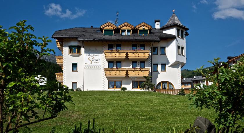
Top hotels near Passo Fedaia

Know more about Passo Fedaia
Passo FedaiaThe Fedaia pass is an alpine pass located on the border between Trentino-Alto Adige and Veneto, between the provinces of Trento and Belluno, which connects the Val di Fassa to Agordino, at the foot of the Marmolada, through the state road 641 of the Fedaia Pass. The pass is formed by a plateau of about 2.5 kilometers, near which there is an artificial lake, Lake Fedaia, used for the production of hydroelectric energy. Some ski lifts and numerous itineraries for excursions on the Marmolada also