18 Attractions to Explore Near Majella National Park
Top Activities Near Majella National Park
Filter By Date
//
Sort By

Attractions & Activities Near You
Checkout attractions and activities near your current locationAll attractions near Majella National Park
Passo San LeonardoPasso San Leonardo is a pass of the central Apennines, located in Abruzzo, in the western part of the Majella massif and south-east of the Morrone Mountains group, within the municipalities of Pacentro and Sant 'Eufemia a Maiella. Route from the state road 487, it connects Pacentro with Sant'Eufemia a Maiella, with the possibility of reaching Campo di Giove through the provincial road 54.
Montagne del MorroneThe Morrone mountains are a mountain group of the Abruzzo Apennines that overlooks the city of Sulmona, enclosed between the Peligna Valley to the west, the Aterno river to the north, and the Majella to the east, from which it is separated by the valley of the Orta stream. Inserted in the territory of the Mountain Community of Maiella and Morrone, it affects the territories of the municipalities of Sulmona, Pratola Peligna, Roccacasale, Pacentro, Corfinio, Sant'Eufemia a Maiella, and Caramanica
Abbazia di Santo Spirito del MorroneThe Abbazia di Santo Spirito del Morrone is a former monastery some five kilometers outside of the town of Sulmona, at the base of Monte Morrone, in the Province of L'Aquila, region of Abruzzo, Italy. This was the main abbey of the Celestine order, a Benedictine order offshoot. By the 19th century, the abbey was deconsecrated, functioning more recently as a prison. In the last decades, restoration has proceeded and it now serves as a Museum.
Bosco di Sant'AntonioThe Bosco di Sant'Antonio nature reserve is a protected natural area located in the municipality of Pescocostanzo, in the province of L'Aquila. It was established in 1986 and since 1992 is part of the Majella National Park and stretches for 550 ha between the ridges of Monte Pizzalto and Monte Rotella. Immersed in numerous centuries-old beech trees, it houses the hermitage of Sant'Antonio. Due to its characteristics, it is an ideal place for horse riding, hiking and cross-country skiing.
Riserva Naturale Regionale Monte Genzana e Alto GizioThe guided nature reserve Monte Genzana and Alto Gizio is a protected natural area located in the municipality of Pettorano sul Gizio , in the province of L'Aquila, and was established in 1996. It includes an area of about 3,160 hectares it is possible to observe the mountains of the Abruzzo National Park to the west and the Majella to the east, the underlying Lake Scanno to the west, and the Cinquemiglia plateau to the south. The park acts as a buffer between the Abruzzo, Lazio and Molise N
Valle PelignaThe Valle Peligna, also known as Conca di Sulmona, is a plateau in central Abruzzo, southern Italy, included in the province of L'Aquila. It has a surface of some 100 km². The valley is crossed by the rivers Aterno and Sagittario. In addition to Sulmona, the main centers in the plateau include Raiano, Vittorito, Corfinio, Pratola Peligna and Pacentro.
Altopiano delle CinquemigliaThe Cinquemiglia plateau was a mountain community comprising the upper valley of the Sangro river and the Maggiore plateau. The territory of the mountain community was largely included in the national park of Abruzzo, Lazio and Molise. It also included the major ski resorts in central- southern Italy : Pescocostanzo , Rivisondoliand Roccaraso , which was later added to that of Pescasseroli.
SagittarioA beautiful river in Italy which is the main tributary of the Aterno-Pescara. Its source is located near Parco Nazionale d'Abruzzo, Lazio e Molise and Scanno. The river flows through so many beautiful locations and it makes the river much beautiful.
Hermitage of Saint VenantiusThe Hermitage of San Venanzio is the site the ancient hermitage of Saint Venantius of Camerino, located above a stream in a remote ravine within a few kilometers north of Raiano, Province of L'Aquila in the Abruzzo, Italy. One of the ancient pilgrimage sites in this area which was also a important site till today.
Lago di ScannoLago di Scanno is a beautiful lake in the Province of L'Aquila, Abruzzo. One of the best places to relax and it was located in the center of mountains which was covered by greenery and it is a good location for trekking and also for swimming.
Riserva Naturale Regionale Cascate del VerdeThe Cascate del Verde regional nature reserve and WWF OASIS is a protected natural area located in the municipality of Borrello, in the province of Chieti. The reserve includes an area of approximately 287 hectares and was established in 2001. The rocky walls on which the waterfalls develop and the surrounding ones are covered by perfectly Mediterranean vegetation.
Lake of ScannoThe Lake Scanno is a lake mountain, located in Abruzzo, belonging to about 3/4 of its surface to the territory of the municipality of Villalago and about 1/4 that of Scanno. The lake is good for public use of the two municipalities mentioned. It originated from an ancient landslide that broke off from Mount Genzana above which blocked the river Tasso in a period between 12,820 and 3,000 years ago.
Lago di San DomenicoThe lake of San Domenico is a mountain lake, located in the municipality of Villalago, in the province of L'Aquila, near the hermitage of San Domenico. The main tributary is the Sagittario, which is also the river that flows from the dam that creates the lake; the lake is also endowed with tributaries of minimal importance such as the waterfalls of the Sega spring and the small stream of Prato Cardoso which enters the lake in karst conditions
Eremo di San Domenico (Prato Cardoso)The hermitage of San Domenico is a small church, located in the territory of the municipality of Villalago, in the Sagittario valley, on the shore of the homonymous Lake of San Domenico. It includes a cave dug into the limestone, in which according to tradition, around the year 1000 the Benedictine monk San Domenico lived.
Piano AremognaThe Piano Aremogna is a highland mountain of ' Abruzzo Southern, located in the municipality of Roccaraso, the lower the province at an altitude of 1500-1600 m above sea level, surrounded to the west by the mountains of Roccaraso, subgroup of the massif of Monte Greek. Its importance derives from the fact that the ski lifts of the Roccaraso ski resort depart from it together with Pizzalto, included within the Alto Sangro ski area.
Riserva regionale Abetina di RoselloThe Abetina di Rosello nature reserve is a protected natural area located in the municipalities of Rosello and Agnone, in the provinces of Chieti and Isernia respectively and was established in 1997. The vegetation of the reserve was the main cause of its establishment. Several flaps fir spontaneous develop some of which Abruzzo and Molise appenine, very important for the preservation of certain plant diversity and plant communities elsewhere now mostly disappeared or severely degraded.
Monte GrecoThe Monte Greek is the highest peak of the group Marsicani Monti, in ' Abruzzese Apennines, located on the edge of the Parco Nazionale d'Abruzzo, within the territory of municipalities of Barrea and Roccaraso. It forms a real mountainous group that divides the Alto Sangro area to the west from that of the major highlands of Abruzzo to the east. Among the most popular routes, the ascent from the road that connects Villetta Barrea to Passo Godi , through a dense beech forest and then, above 1900 m
Monte CapraroThe Mount Capraro is a mountain of 1,730 meters above sea level, of ' Samnite Apennines, situated in Upper Molise , in the province of Isernia . Extending about 6 km from the border with the province of L'Aquila , in Abruzzo , it is the fifth highest peak in Molise and in the province of Isernia . Administratively included in the territory of the municipalities of San Pietro Avellana and Capracotta , at its foot lies the source of the Trigno river.
Map of attractions near Majella National Park
Top hotels near Majella National Park
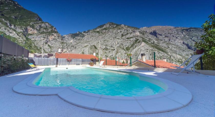
175 Reviews
9.3
$95.53 per nightSelect
Know more about Majella National Park
Majella National ParkThe Majella National Park is an important biodiversity refuge. The area is characterized by a layered cultural and spiritual heritage shaped by millennia of human-environment interaction. It includes wide lands with particular wilderness aspects, the rarest and most precious part of the biodiversity national heritage. The 740.95 km2 area, especially the Montagna della Majella, has been subject to a major international geoscientific research Project.