Custer County - 22 Attractions You Must Visit
Contents in This Page
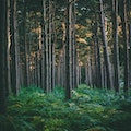
About Custer County
Custer County is a county located in the U.S. state of Colorado. A large percentage of the county is National Forest land in the Sangre de Cristo Mountains on the west side and in the Wet Mountains on the east. The only lake of size is the DeWeese Reservoir in the north end of the Wet Mountain Valley.Types of Attractions in Custer County


Popular Activities And Trips in Custer County
Filter By Date
//
Sort By
List of Attractions in Custer County
Beckwith RanchThe Beckwith Ranch is a historic cattle ranch in the Wet Mountain Valley of Custer County, Colorado, USA. The headquarters spread over eleven buildings, ten of which have been listed on the National Register of Historic Places since May 20, 1998. It was established by Elton and Edwin Beckwith, two brothers from Mount Desert Island, Maine.
Outdoors - Other
Bishop CastleBishop Castle is an "elaborate and intricate "one-man project" named after its constructor, Jim Bishop, that has become a roadside attraction in central Colorado.The "castle" is located in south central Colorado on State Highway 165 in the Wet Mountains of Southern Colorado in the San Isabel National Forest, southwest of Pueblo, Colorado.
Iconic Buildings
Old Ruins
Broken Hand PeakBroken Hand is one of the first mountains to greet hikers and drivers on the South Colony Road. Its steep east face is a brilliant demonstration of the rock strata in the area.
1 Day Treks
Mountain Peaks
Brush Creek LakesThe Brush Creek Lakes are two of the largest lakes in the Sangre de Cristo Range, and the fishing can be good.The lakes are situated right on the edge of timberline in a picturesque alpine cirque just east of Thirsty Peak and Lakes Peak.
Lake/ River/ Ponds
Cottonwood PeakCottonwood Peak is a mountain in northwestern British Columbia, Canada, located in the Iverson Creek area. It is a volcanic feature of the Northern Cordilleran Volcanic Province that formed in the past 1.6 million years during the Pleistocene Epoch.
1 Day Treks
Mountain Peaks
DeWeese ReservoirDeWeese Reservoir is located in northern Custer County, Colorado between the Sangre de Cristo Mountains and the Wet Mountains. The ditch and reservoir company owns the land under the reservoir and most of the land around it. The company has arrangements with other organizations to store water and for the use of the space.The lake and the land immediately surrounding it are also designated as the DeWeese Reservoir State Wildlife Area.
Lake/ River/ Ponds
Hermit LakeHermit Lake is an isolated body of water, located way up at 11,314 feet in elevation west of Westcliffe, Colorado. Hermit Lake is found within the San Isabel National Forest and can be accessed via a short out & back trail. It is a moderately trafficked destination because of its incredibly scenic alpine atmosphere. It is found in Custer County, tucked in the Sangre De Cristo Mountains north of Great Sand Dunes National Park and Preserve.
Lake/ River/ Ponds
Hermit PassHermit Pass is a high mountain pass at an elevation of 3.986m above the sea level, located in Custer County, in the U.S. state of Colorado. It's one of the highest roads of Colorado. It is recommended that beginner riders avoid this road. The route demands 100% concentration.
Mountain Passes
Horn LakesHorn Lake is a 12 acre lake located in COlorado. It has a maximum depth of 25 feet. Fish include Panfish, Largemouth Bass and Northern Pike.
Lake/ River/ Ponds
Horn Peak Trailhead The Horn Creek Trailhead is located near Horn Creek Ranch southwest of the town of Westcliffe. To get to the trailhead, drive south from Westcliffe on SH-69 and turn right on Schoolfield Road after ~3 miles. Go a mile west on Schoolfield and then turn left on Macey Lane and head south for 2 miles. Turn right on Horn Road and head west to Horn Creek Ranch, which is reached after ~3.5 miles. At the ranch, turn right at a signed junction and reach the Horn Creek TH after .25 miles
1 Day Treks
Humboldt PeakHumboldt Peak is a high mountain summit of the Crestones in the Sangre de Cristo Range of the Rocky Mountains of North America. The 14,070-foot fourteener is located in the Sangre de Cristo Wilderness of San Isabel National Forest. The standard route on the peak is a hike along a trail, with rock scrambling near the summit. The trail climbs the peak from the South Colony Lakes basin, accessed from the east side of the range.
1 Day Treks
Mountain Peaks
Lake IsabelLake Isabel is a reservoir located in the San Isabel National Forest in Pueblo and Custer counties, in Colorado, United States. The lake is in the Wet Mountains. The lake is open to fishing year round and is regularly stocked by Colorado Parks and Wildlife. Available activities include fishing, hiking, camping and sledding in the winter.
Lake/ River/ Ponds
Lake of the CloudsThe lake is situated in a valley between two ridges in the Porcupine Mountains. Surrounded by virgin wilderness and stunning vistas, the lake is a popular destination for hikers, campers, and fishermen. The lake is a prominent feature of the park, and can be viewed at the Lake of the Clouds Overlook at the west terminus of the former Michigan highway. The state park occasionally hosts a nighttime sky watch at the lake.
Lake/ River/ Ponds
Little Horn PeakLittle Horn Peak is located in the northern section of the Sangre De Cristo Mountains of Southeastern Colorado. A prominent peak facing east towards the Wet Mountain Valley just south of the town of Westcliffe. It lies within the boundaries of the Sangre De Cristo Wilderness. Due to the its steep rocky terrain and class 3 exposures on its final approach, at 13,143ft, Little Horn Peak boasts a challenge to all who climb it.
1 Day Treks
Mountain Peaks
Mount AdamsMount Adams is a high mountain summit of the Crestones in the Sangre de Cristo Range of the Rocky Mountains of North America. The 13,937-foot thirteener is located in the Sangre de Cristo Wilderness, 5.1 miles east by north of the Town of Crestone, Colorado, United States, on the drainage divide separating San Isabel National Forest and Custer County from Rio Grande National Forest and Saguache County.
1 Day Treks
Mountain Peaks
Music Pass TrailheadThis trailhead provides access to Music Pass and the Sand Creek valley, including the two large alpine lakes, Upper Sand Creek Lake and Lower Sand Creek Lake. A great many peaks can be climbed from this trailhead, including Cleveland Peak, Tijeras Peak, Music Mountain, Milwaukee Peak, Marble Mountain, and Blueberry Peak.
1 Day Treks
Pike and San Isabel National ForestThe Pike-San Isabel National Forests & Cimarron and Comanche National Grasslands covers nearly three million acres from western Kansas and Colorado's highest mountain peaks along the Continental Divide. This landscape offers a variety of ecosystems rich in history, geology, scenery, wildlife habitat and recreation opportunities.
Forests
Map
Comments
Please Sign In to add your comments
For more information about Custer County, visit : https://en.wikipedia.org/wiki/Custer_County,_Colorado
This site is protected by reCAPTCHA and the Google Privacy Policy and Terms of Service apply