Alpine County - 52 Attractions You Must Visit
Contents in This Page
About Alpine County
This is the least populous county in California state. There are no incorporated cities in the county.Types of Attractions in Alpine County


Popular Activities And Trips in Alpine County
Filter By Date
//
Sort By
List of Attractions in Alpine County
Alpine County MuseumThis is a museum telling the Native American and Pioneering history of Alpine County California.
Museums
Bear LakeBear Lake is a lake in Alpine County and has an elevation of 7,267 feet. The lake is formed by snow melt, so the water is very cold until well into the summer. It’s regularly planted with trout – making for some great fishing here on 180 surface acres with an average depth of about 40 feet. Hikers enjoy the four-mile trail around the lake.
Lake/ River/ Ponds
Boulder PeakBoulder Peak is Boulder's highest and least traveled summit at 8,549 feet. The summit is rocky and requires some scrambling, but the views at the top are well worth it. This peak is accessed by connecting the Mesa Trail with Shadow Canyon that places you at the saddle between South Boulder Peak and Bear Peak. It offers a demanding 3.7-mile hike situated above the South Mesa in the famous Flatirons region near Boulder Colorado.
1 Day Treks
Mountain Peaks
Bull Run LakeBull Run Lake is a reservoir, an impoundment of the Bull Run River in the U.S. it rates highly as an oligotrophic lake, a very clean source of water. The lake basin receives more than 110 inches of rain annually due to its location in the Cascade Range. Water from the reservoir first flowed into the Portland water system on January 2, 1895. President Theodore Roosevelt restricted entry to all but government agents and water company employees and banned stock grazing on April 28, 1904.
Lake/ River/ Ponds
Burnside LakeBurnside Lake is a lake in Alpine County and has an elevation of 8143 feet. it is situated southwest of Hawkins Peak. it is one of the beautiful recreational post here and is also famous for fishing and other activities.
Lake/ River/ Ponds
Calaveras Big Trees State ParkCalaveras Big Trees State Park is a state park of California, preserving two groves of giant sequoia trees. It has been a major tourist attraction since 1852, when the existence of the trees was first widely reported, and is considered the longest continuously operated tourist facility in California.
Parks
National Parks
Caples LakeCaples Lake is located 59 miles east of Jackson at an elevation of 7,800 feet. The 600 acre lake has 6 miles of shoreline. The lake has been used by many different groups of people including Native Americans, 49ers, and resort owners so it is known by a few different names. It offers a variety of different recreational opportunities such as hiking, fishing, and skiing within close proximity.
Lake/ River/ Ponds
Carson PassCarson Pass is located on the south side of Highway 88 at Carson Pass 60 miles east of Jackson in Alpine County. The historic pass was a point on the Carson Trail during the California Gold Rush and was used for American Civil War shipping to California until the completion of the First Transcontinental Railroad. The Pacific Crest Trail traverses the Carson Pass summit, which has California Historical Landmark #315 at CA 88 postmile 6.09 where Kit Carson carved his name into a tree.
Mountain Passes
Carson Pass Sno-ParkThe Carson Pass Sno-Park is located near Caples Lake on the south side of Highway 88. It is popular with hikers throughout most of the year, and the Pacific Crest National Scenic Trail, Tahoe-Yosemite Trail, and the Emigrant Summit Trail have access points at Carson Pass. Several high-elevation lakes can be accessed from Carson Pass.
Mountain Passes
Carson-Iceberg WildernessThe Carson–Iceberg Wilderness is a federal wilderness area located 80 miles northeast of Stockton, California. It encompasses 160,000 acres and was designated by the California Wilderness Act of 1984. It protects an area of High Sierra landscape with elevations from 4,800 feet to 11,462 feet along the Sierra Mountains from Ebbetts Pass to Sonora Pass in the south. The wilderness supports large herds of mule deer and there is also good habitat for black bear
1 Day Treks
Mountain Peaks
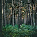
Forests
Cleveland National ForestThis is a national forest that encompasses around 460,000 acres which is a warm dry Mediterranean climate that prevails over the Forest. It is the southernmost National forest of California. It is administered by the United States Forest Service, which is a government agency.
Outdoors - Other
Forests
Deadwood PeakDeadwood Peak lies in the center of Mokelumne Wilderness across Summit City Creek from Round Top. It is also situated on the shared border of Pierce County and Yakima County in Washington state. Deadwood Peak is set on the crest of the Cascade Range, immediately north of Yakima Peak and Chinook Pass, with the Pacific Crest Trail traversing its east slope.
1 Day Treks
Mountain Peaks
Disaster PeakDisaster Peak a grey colored, and at first sight, unimpressive looking pile of rocks located in the Carson - Iceberg Wilderness. There are several taller and more impressive looking peaks in the area. The climbers trail is faint and easy to lose, so one often needs to rely on cross country travel. The summit “block” is composed of piled rock and boulders, some a bit loose.
1 Day Treks
Mountain Peaks
Duck LakeDuck Lake lies in a glacial cirque, surrounded on three sides by peaks with its outlet on the far side. As a result, camping around Duck Lake is limited. Reflections across the expanse of Duck Lake are mesmerizing when they happen. You can continue backpacking from here by heading towards Purple Lake and Lake Virginia, or you can day hike around the area or simply enjoy being lakeside in the wilderness for awhile.
Lake/ River/ Ponds
Ebbetts PassThe Ebbetts Pass National Scenic Byway is one of only seven nationally designated byways in California and 151 in the nation.Ebbetts is the eastern of two passes in the area traversed by State Route 4. The western pass is the Pacific Grade Summit. The pass is registered as a California Historical Landmark. The Pacific Crest Trail, a 2,650-mile long National Scenic Trail crosses State Route 4 at Ebbetts Pass.
Mountain Passes
Eldorado National ForestThe Eldorado National Forest is nestled in the dramatic central Sierra Nevada of California and bordering Nevada.The forest is bordered on the north by the Tahoe National Forest, on the east by the Lake Tahoe Basin Management Unit, on the southeast by the Humboldt-Toiyabe National Forest, and to the south by the Stanislaus National Forest. The forest is also home to 297 lakes and reservoirs, which total 11,994 surface acres. This Forest provides diverse recreational opportunities to the public.
Forests
Elephants BackElephants Back is a peak in Alpine County and has an elevation of 9580 feet. Elephants Back is situated south of Frog Lake, and south of Carson Pass. it is one of the iconic location where you can have a good trek and also there are so many other adventure opportunities to explore.
1 Day Treks
Mountain Peaks
Fourth of July LakeFourth of July Lake is an alpine lake in Custer County, Idaho, United States, located in the White Cloud Mountains in the Sawtooth National Recreation Area. The lake is accessed from Sawtooth National Forest trail 109. This lake is in top form and is one of the areas top producing winter-only lakes for trout fishing. It is a popular destination for fly anglers.
Lake/ River/ Ponds
Map
Comments
Please Sign In to add your comments
For more information about Alpine County, visit : https://en.wikipedia.org/wiki/Alpine_County,_California
This site is protected by reCAPTCHA and the Google Privacy Policy and Terms of Service apply