18 Attractions to Explore Near Monte Moro Pass
Top Activities Near Monte Moro Pass
Filter By Date
//
Sort By

Attractions & Activities Near You
Checkout attractions and activities near your current locationAll attractions near Monte Moro Pass
MattmarkseeThe Mattmark dam, the biggest earthen dam in Europe, lies south of the Saas Valley. The reservoir, used for generating electricity, is a popular destination with visitors interested in learning technical details of its operation and who love its wild, romantic location. The lake lies at a height of 2,197 metres above sea level, between the massifs of the Rimpfischhorn and Stellihorn. The highest peak visible from the lake is the Strahlhorn
StrahlhornThe Strahlhorn is a mountain of the Swiss Pennine Alps, located south of Saas-Fee and east of Zermatt in the canton of Valais. It lies on the range that separates the Mattertal from the Saastal and is located approximately halfway between the Rimpfischhorn and the Schwarzberghorn. There are three less known peaks of the same name in Switzerland. A beautiful place to spend some beautiful time.
AllalinhornThe Allalinhorn is a mountain in the Pennine Alps in Switzerland. It lies between Zermatt and Saas-Fee in the canton of Valais and is part of the Mischabel range, which culminates at the Dom . It was first climbed by London barrister Edward Levi Ames, a member of the Imseng family and Franz-Josef Andenmatten on 28 August 1856. One of the nice trekking area and also it offers a nice panoramic view of this area.
MittelallalinThe highest underground funicular in the world, the metro alpin, leads to the Mittelallalin. At 3500m, the highest revolving restaurant in the world affords close-up views of the giant peaks of the Alps. Next door, visitors experience the world of glaciers firsthand in the world’s largest ice pavilion. Twenty kilometers of well-groomed summer pistes on the Fee Glacier, ski lifts, spectacular views of the highest Valais peaks, as well as the warm summer sun, make for unforgettable summer skiing.
Monte RosaMonte Rosa is a 41.7 kilometer out and back trail located near Zermatt, Valais, Switzerland that features a river and is rated as difficult. The trail is primarily used for hiking, walking, nature trips, and backpacking.
ZumsteinspitzeThe Zumsteinspitze is a huge mountain peak located in the Pennine Alps on the border between Italy and Switzerland. It was the first summit of the Monte Rosa massif to be climbed. Its name comes from the topographer Joseph Zumstein, who explored the peak with other scientists. It is one of the 4 Monte Rosa summits looming high above the Macugnagna valley and forming the famous Monte Rosa East wall, the biggest and highest rock face in the Alps.
SignalkuppeThe Signalkuppe is a peak in the Pennine Alps on the border between Italy and Switzerland. It is a minor peak in the Monte Rosa massif. The mountain gets its name from "the Sign", a prominent gendarme atop the eastern ridge, which was demolished when the Reina Margherita shelter was built.
Margherita HutThe Margherita Hut is situated on Punta Gnifetti at a height of 4556m on the Monte Rosa massive. It is clearly visible from the valley and catches the eye of all who look up towards the peaks. It is the highest refuge in Europe, it houses important labor for scientific research and it is dedicated to Queen Margaret of Savoy who overnighted in 1893, the year of its inauguration.
AlphubelThe Alphubel is a beautiful mountain of the Swiss Pennine Alps. There is a 17.9 kilometer out and back trail located near Täsch, Valais, Switzerland that offers the chance to see wildlife and is rated as difficult. The trail is primarily used for rock climbing and nature trips. The morphology of the Alphubel and its proximity to the Saas-Fee funicular makes the Alphubel one of the comparatively easier four-thousands of the Swiss Alps to climb.
ParrotspitzeThe Parrotspitze or Punta Parrot is a mountain in the Pennine Alps, located in the massif of the Monte Rosa, along the border between Italy and Switzerland. Presenting the mountain as a long and sharp ridge arranged in a west-east direction, it is possible to ascend it easily starting from the Col del Lys or from the Col Sesia, the col that separates it from the nearby Punta Gnifetti. A longer and steeper ascent unfolds up the Valais face starting from the Fratelli Gugliermina hut.
BalmenhornThe Balmenhorn is a 4,167 m listed elevation belonging to the Monte Rosa massif in the Pennine Alps. It is particularly known because on its summit there is the Felice Giordano bivouac and the majestic statue of Christ of the Peaks. It can be seen along the road that leads from Capanna Giovanni Gnifetti to Capanna Regina Margherita. It is not commonly listed among the Alpine peaks higher than 4000 meters because it does not meet all the criteria to be considered a peak in its own right.
TäschhornThe Täschhorn is a mountain in the Pennine Alps in Switzerland, lying south of the Dom within the Mischabel range. The first ascent of the mountain was by John Llewelyn Davies and J. W. Hayward with guides Stefan and Johann Zumtaugwald and Peter-Josef Summermatter on 30 July 1862. It was one of the nice trekking destinations and also a nice camping area too.
Monte Rosa HutThe Monte Rosa Hut is a mountain hut located near Zermatt on the Monte Rosa massif and above the Grenzgletscher sitting on a glacier-free rocky part called Untere Plattje at an altitude of 2,883 metres. It is owned by the Swiss Alpine Club. The hut is the start of the normal route to the summit and other mountains in the area. The first hut was built in 1894–1895 just next to the then still much higher Border Glacier at an altitude of 2,795 metres. A completely new building was inaugurated in 20
Vincent PyramidThe Vincent Pyramid is a mountain of the Monte Rosa massif in the Pennine Alps. It is located entirely in Italian territory along the watershed that divides the upper Lys valley from the upper Valsesia descending from Ludwigshöhe. The summit is bordered to the west by the Lys glacier, to the south by the Indren glacier, and to the east by the Piode glacier. One of the risky trekking destination and also the summit offers a beautiful panoramic view of this area.
LyskammLyskamm, also known as Silberbast is a mountain in the Pennine Alps lying on the border between Switzerland and Italy. It consists of a five-kilometer-long ridge with two distinct peaks. The mountain has gained a reputation for seriousness because of the many cornices lying on the ridge and the frequent avalanches, thus leading to its nickname the Menschenfresser One of the risky trekking destinations in Switzerland and the climate is also very cool.
DomDom, mountain peak, Valais canton, southern Switzerland. Part of the heavily glaciated Pennine Alps called the Valaisan Alps in Switzerland, it rises to 14,911 feet. The Dom is the third highest peak of the Alps, after Mont Blanc and Monte Rosa, and is the highest entirely in Switzerland. It was first climbed in 1858, by the British alpinist J.L. Davies.
UnterrothornThe Unterrothon is a mountain of the Swiss Pennine Alps, overlooking Zermatt in the canton of Valais. It is located west of the Oberrothorn, on the range north of the Findel Glacier. The summit can be reached by cable car via Sunnegga and Blauherd. The Rothorn paradise is one of the main ski areas located around Zermatt.
WeissmiesWeissmies is a prominent mountain surrounding the famous Saas valley in Wallis, Switzerland. Weissmies is one of the 82 mountains above 4000 meters in the Alps and therefore a popular objective for climbers. “Mies” is a local dialect for the German word “moos” which translates into “moss”. So the name “Weissmies” literally means “white moss”, which refers the glaciated summit of the mountain, resembling a white moss-like cover. Weissmies is considered an “easy” 4000-meter peak since the normal r
Map of attractions near Monte Moro Pass
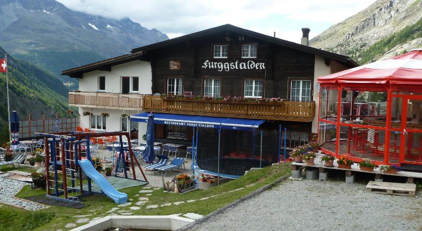
Top hotels near Monte Moro Pass
Know more about Monte Moro Pass
Monte Moro PassThe Monte Moro Pass is an Alpine pass located on the border between Switzerland and Italy. It connects Saas-Almagell in the Swiss canton of Valais to Macugnaga in the Italian region of Piedmont. The pass lies at the foot of Monte Moro. Historically the Monte Moro is an important border crossing between the valleys of Saas and Macugnaga. It is traversed by a trail and is one of the highest passes on the Monte Rosa Tour.