18 Attractions to Explore Near Ptarmigan Lake Trailhead
Top Activities Near Ptarmigan Lake Trailhead
Filter By Date
//
Sort By

Attractions & Activities Near You
Checkout attractions and activities near your current locationAll attractions near Ptarmigan Lake Trailhead
Ptarmigan LakePtarmigan Lake is a remote lake that sits at 12,147 feet in elevation above Chaffee County, Colorado. This lake offers breathtaking views and ample outdoor activities, making it a very popular destination during the summer and fall. visitors must hike up 3 miles of gradual incline, and are rewarded with an astonishing view of the blue water surrounded by towering peaks, pines, and glaciers.
Denny Creek TrailheadThis is a popular trail, which is gentle, family friendly grade with amazing destinations. The natural water slide area at Denny Creek is a must visit for families. The trails offer an authentic mountain experience as they go through the Collegiate Peaks Wilderness.
Cottonwood PassA high mountain pass on the Continental Divide of the Americas in the Sawatch Range of Colorado. It rises to the west out of Buena Vista, heading over the Continental Divide. It’s an amazing mountain pass to see colorful fall aspen groves. It connects with Almont near Crested Butte, making it an excellent summer trip. The road closes in winter due to heavy snowfall, usually sometime in October.
Mount YaleMount Yale is the eighth highest peak in the Sawatch Range and twenty-first in the state on Colorado. There are two routes up the mountain, each with accessible trailheads year-round. This makes it a good training peak for more difficult hikes and climbs. With lots of camping in the area, it’s a great opportunity to stay and climb several Sawatch 14ers in one trip.
Collegiate Peaks WildernessThe Collegiate Peaks Wilderness is a 168,000-acre area located in central Colorado between Leadville and Buena Vista to the east and Aspen to the west and Crested Butte to the southwest. There are numerous alpine creeks in the area's wide valleys and these are all quite marshy. Snow does not usually begin to melt until May or June and it remains year-round in places on some of the high peaks.
Avalanche TrailheadThe Avalanche trailhead is a major access point for the Colorado Trail near Buena Vista. This is a popular trailhead for winter recreationists and provides ample parking for the many snowmobilers who converge on the area. Weekend snowmobilers love to ride to the top of Cottonwood Pass and over the Continental Divide to Taylor Park.
Cottonwood LakeA beautiful lake located in the middle of a small forest and is famous for fishing and so many other leisure activities. The lake has such a scenic setting nestled within the mountains. Water access is easy and though the water is cold.
North Cottonwood Creek TrailheadThe North Cottonwood trail travels west for 4.3 miles to Kroenke Lake. The trail has numerous creek crossing and is lush and green with alpine vegetation. Take advantage of this trail in the peak of summer for wildflower season with July being the best month for the breathtaking flowers.
Mount PrincetonMount Princeton rises dramatically from the upper Arkansas River valley, its 14,204-foot summit a stately sentinel over the land below. Mount Princeton carries many distinctions, both historic, geological and recreational. It is also a good trekking destination nd also it offers nice views of this area.
Mount ColumbiaMount Columbia is a high mountain summit of the Collegiate Peaks in the Sawatch Range of the Rocky Mountains of North America. The 14,077-foot fourteener is located in the Collegiate Peaks Wilderness of San Isabel National Forest, 9.9 milesnorthwest by west of the Town of Buena Vista in Chaffee County, Colorado. This trail is great for birding, horseback riding, and mountain biking, and it's unlikely you'll encounter many other people while exploring.
Ice MountainIce Mountain is a high mountain summit of the Collegiate Peaks in the Sawatch Range of the Rocky Mountains of North. The 13,958-foot thirteener is located in the Collegiate Peaks Wilderness, 17.1 miles west-northwestn of the Town of Buena Vista, Colorado. A good trekking destination and also there are so many things to see and do.
Napoleon PassNapoleon Pass is a high mountain pass in the Sawatch Range of the Rocky Mountains of Colorado. The pass is the saddle between Napoleon Mountain to the west and Fitzpatrick Peak to the east and divides the watersheds of Middle Willow Creek to the north and Quartz Creek to the south. Napoleon Pass is traversed by Forest Trail 540 and can be accessed from the towns of Tincup to the north and Pitkin to the south.
West ApostleA majestic peak located in the heart of Chaffee and it offers a beautiful, streamside hike up to a unique lake, interesting ridge combinations, and panoramic views from atop the Continental Divide, this may be your mountain. It offers not only offers awesome scenery above timberline, but also below.
Emerald PeakEmerald Peak is a high mountain summit of the Collegiate Peaks in the Sawatch. The 13,911-foot thirteener is located in the Collegiate Peaks Wilderness of San Isabel National Forest, 14.7 miles west-northwest of the Town of Buena Vista in Chaffee County, Colorado, United States. It is a good trekking destination and also it offers beautiful views and also it offers so many adventure options too.
Mount HarvardMt. Harvard is the third highest peak in Colorado and only one of three 14ers within Colorado that rises above 14,400 feet. Generally considered a challenging route, it takes an average of 8 h 49 min to complete. This is a very popular area for camping, fishing, and hiking, so you'll likely encounter other people while exploring.
Agnes Vaille WaterfallAgnes Vaille Falls is nestled in the mountainside of Chalk Creek Canyon, south of Buena Vista. It requires a short, uphill hike to the falls.This trail is, however, still being taken today, as there are no officials signs stating it is still closed. Social media shows much activity on the once closed trail.
Cascade CanyonCascade Canyon is located in Grand Teton National Park, in the U.S. state of Wyoming. It has numerous polished glacial erratics, hanging cirques and a U-shape as evidences that demonstrate that glaciers once filled the canyon to a depth of at least 2,000 feet. Cascade Creek now flows where the glaciers once did and the numerous waterfalls, such as the 100-foot tall Hidden Falls, found within the gorge are popular destinations with tourists.
Cumberland PassCumberland Pass is a high mountain pass in the Sawatch Range of the Rocky Mountains of Colorado. The pass is traversed by Forest Road 765 and can be accessed from the towns of Tincup to the north and Pitkin to the south. The Cumberland Pass road was built in 1882, connecting the mining towns of Tin Cup to the north and Pitkin to the south. Evidence of past and present human activities can be found at Cumberland Pass.
Map of attractions near Ptarmigan Lake Trailhead
Top hotels near Ptarmigan Lake Trailhead
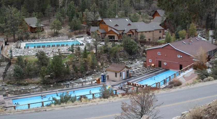
25 Reviews
9.4
$281.97 per nightSelect
Know more about Ptarmigan Lake Trailhead
Ptarmigan Lake TrailheadThis is an awesome trail that takes hikers all the way from the trailhead off of 306, along Ptarmigan Creek, and out to Ptarmigan Lake. This 6.5-mile round trip hike takes visitors from the trailhead, through the forest, alongside lakes, and finally to the majestic Ptarmigan Lake itself. The trail is spectacular and offers visitors one the best wildflower viewing spots during the month of July.