18 Attractions to Explore Near Braunarlspitze
Top Activities Near Braunarlspitze
Filter By Date
//
Sort By

Attractions & Activities Near You
Checkout attractions and activities near your current locationAll attractions near Braunarlspitze
KörberseeA picturesque lake located within the "Lechtaler" Alps in Vorarlberg. With a surface of ~ 5 ha it is a smaller lake in the province. The water possesses excellent drinking water quality and gives a protected living space to fishes and rare plants. The lake can only be reached on foot; estimated walking time 45 minutes.
Skyspace LechThe Skyspace Lech is a walk-in art installation by James Turrell. THis is an enclosed space which is open to the sky through a large hole in the ceiling or dome. It usually is large enough for about 15 people. It was created by light artist James Turrell blends discreetly into the high-alpine landscape of the Arlberg mountains in western Austria
Hochtannberg PassA majestic mountain pass in the Austrian Alps in the Bundesland of Vorarlberg. It connects Warth in the Lech Valley to the east with the valley of the Bregenzer Ach near Schoppernau to the west. It is traversed by the Bregenzerwaldstraße. It connects the Allgäu Alps to the headwaters of the Lech.
Red WallA majestic mountain in the Lechquellen Mountains range of Vorarlberg, in western Austria. it rises from the valley floor between the Großes Walsertal in the north, and Dalaas in the south. The mountain is a popular hiking destination, but designated only for experienced, sure-footed mountain walkers.
Zürser SeeA natural high mountain lake above the Zürs district, which belongs to the municipality of Lech .Its water is led through a tunnel under the Obere Wildgrubenspitze to the Spullersee. The area around Lake Zürs is particularly well-known for its ski area, in which several cable cars lead to and from Lake Zürs. There are also numerous hiking trails to the lake outside of the winter season.
SpullerseeThe Spullersee is an originally natural high mountain lake in Vorarlberg . It was dammed up from 1919 to 1925 by the Austrian Federal Railways on the occasion of the electrification of the Arlbergbahn and has been used to generate energy ever since. The lake is a popular fishing lake in summer. He is known for his trout . Fishing is not possible between December and February due to icing.
KarhornThe Karhorn is a 2416 m above sea level. A. high mountain in the Lechquellen Mountains . It is the main summit of the Karhorn group named after him. It is located southwest of Warth between the Auenfelder Horn in the northwest and the Warther Horn in the northeast. The Karhorn can be climbed from the Auenfelder Sattel on a marked trail over the Südsporn with alpine difficulty UIAA I
Ski Arlberg (St. Anton, St. Christoph, Stuben, Lech, Zürs, Warth, Schröcken)A majestic ski area situated in the Arlberg massif in the Austrian states of Vorarlberg and Tyrol. The area consists of two parts, namely: Arlberg East and Arlberg West. The ski area has a rich lift system consisting of a variety of aerial and surface lifts including 15 cable cars. The Ski Arlberg ski resort has been the venue for numerous World Cup ski races in the past.
FormarinseeA mountain lake with a natural spring in the Lechquellen mountains. It is fed by a natural spring and builds itself annually new from the snowmelt. That is why his size varies. Normally the lake is about 500 m long and 400 m wide with a maximum depth of 17 m.
Großer WiddersteinGroßer Widderstein is the highest and most dominating mountain of Klein Walsertal and located at the southern end of the valley. The mountain is formed out of dolomite rock and has a massive appearance from any side. It is the highest peak in the subgroup of the Southeastern Walsertal Mountains. There are several climbing routes on the faces of the Widderstein.
GroßwalsertalA side valley of the Walgau and stretches from this in an easterly to north-easterly direction to the mountainous center of the country. The end of the valley borders on the Bregenz Forest . The great Walsertal is best known for the UNESCO biosphere park of the same name.The name of the valley comes from the Walsers who moved here from Valais in the 13th century .
GeißhornA majestic high mountain in the Allgäu Alps on the German - Austrian border. An iconic location with lots of natural specialities. The summit can be climbed from the east from the Mindelheimer Hütte via the south ridge on the marked path. The saddle under the south ridge can also be reached from the north, from Bödmen through the Gemstelbachtal .
Flexen PassA majestic high mountain pass in the Austrian Alps in the Bundesland of Vorarlberg. The road over the pass is asphalted. It’s usually open all year long and connects the upper Lech River valley between Warth, Lech, and Zürs with the Klostertal near Stuben. It offers nice views of this area and also there are so many other options for leisure too.
GrünhornA majestic mountain located on the ridge between the two largest glaciers of the Alps: the Aletsch Glacier to the west and the Fiescher Glacier to the east. To the south lies the Gross Wannenhorn and, to the north, the Gross Fiescherhorn. The starting point for the normal route via the Grünegghorn and the south-west ridge is the Konkordiahütte at 2,850 metres (9,350 ft), which can be reached from Fiesch.
KlostertalKlostertal is located between Bludenz and the Arlberg and has been an extremely popular holiday region for a long time. Hospitality has a long tradition here. The Klostertal extends over a length of around 30 kilometers from Bludenz to the Arlberg Pass and forms the connection from Vorarlberg to the rest of Germany.
FlexenbahnThe Flexenbahn is an aerial cableway in Stuben am Arlberg in the Austrian province of Vorarlberg. It is part of the Ski Arlberg ski area and borders both of the Austrian provinces of Vorarlberg and Tyro. lThe valley station is located in the area of Alpe Rauz and it is the key link with which the largest contiguous ski resort in Austria could be realized.
Walmendinger HornWalmendinger Horn is a high mountain of the Allgäu Alps in Vorarlberg , Austria. it rises on the north side of the Kleinwalsertal west of the 1215 m high Mittelberg. It offers a good view in all directions of the nearby peaks of the Hohen Ifen. A cabin cable car, the Walmendingerhornbahn , has been leading up the mountain since 1966.
WalmendingerhornbahnThe Walmendingerhornbahn is a mountain railway in Mittelberg in the Kleinwalsertal . The valley station is located at 1207 m above sea level. A. not far from the Mittelberg village center. The train ends shortly before the summit of the Walmendingerhorn at 1948 m above sea level. A.The approximately ten kilometers of slopes are aimed more at experienced winter sports enthusiasts. There have been ski lifts on the Walmendingerhorn since 1968.
Map of attractions near Braunarlspitze
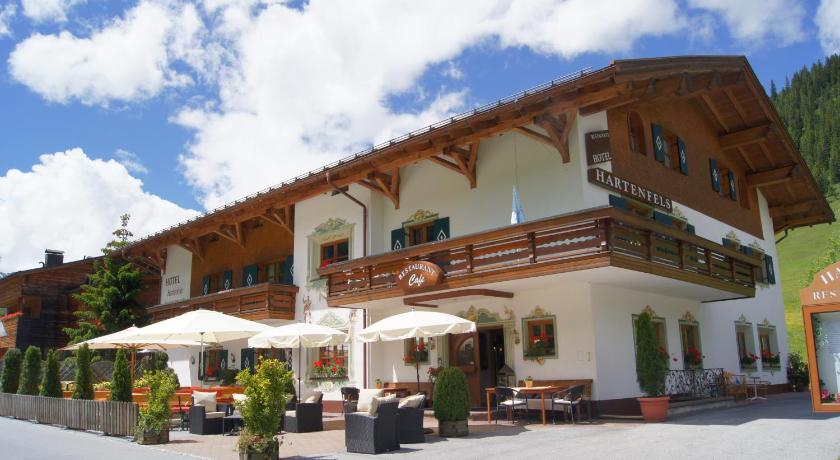
Top hotels near Braunarlspitze


Know more about Braunarlspitze
BraunarlspitzeThe Braunarlspitze is the highest peak in the northern half of the Lechquellen Mountains and is therefore particularly noticeable from the Bregenzerwald . It is the culmination point of a ridge several kilometers long from the Butzensattel in the east to the west. The Mellau mountain guide Mathias Wüstner made the first ascent in 1877 over the north ridge.