18 Attractions to Explore Near Beara way
Top Activities Near Beara way
Filter By Date
//
Sort By

Attractions & Activities Near You
Checkout attractions and activities near your current locationAll attractions near Beara way
Derreenataggart Stone CircleDerreenataggart Stone Circle is about 1.5km west of Castletown Bere, close to the road and open to the public. It is about 8m in diameter and twelve stones of a probable fifteen survive. Thirty metres south-west of the circle, site CO115-011001 is "a raised sub-circular area of rough ground with a recent rectangular depression at its western edge".
Staigue Stone FortStaigue Fort is probably one of the best examples of an ancient ringfort in Kerry. The fort is thought to have been built during the late Iron Age, probably somewhere between 300 and 400 AD, as a defensive stronghold for a local lord or king. The fort consists of a massive circular rampart surrounded by an external bank. The wall is up to 5.5m high and 4m thick, surrounding a circular area of 27.4m in diameter. It shows great skill and craftsmanship in the area of stone building.
Allihies Copper Mine MuseumThe Allihies Copper Mine Museum is a museum dedicated to the history of copper mining in the Allihies area in County Cork. It is situated on the Wild Atlantic Way. The exhibitions cover all aspects of the history of copper mining in the area, from prehistoric times all the way up to the nineteenth century and the Industrial Revolution. The displays also cover the local geology and the social history of the mining heritage.
Derrynane HouseDerrynane House was the home of Irish politician and statesman, Daniel O'Connell. It is now an National Monument and part of a 320-acre national historic park. The house is located on the Iveragh peninsula on the Ring of Kerry near the village of Derrynane in County Kerry, Ireland. The house displays relics of O'Connell's life and career. Guided tours of the house are available, along with a visual presentation. Access for visitors with disabilities is limited to the ground floor.
Derrynane BeachAn extensive sandy beach in Derrynane Bay, County Kerry. The sheltered dune-backed beach is a crescent of white sand overlooking Abbey Island with its ancient burial ground and ruins of a long-forgotten mediaeval church. The area is rich in biodiversity and of significant national importance. It is a safe and sheltered beach, ideal for swimming and other water sports.
Ballydonegan Beach AllihiesA beautiful beach which was down the hill from Allihies and is the best beach in the locality. While the area provides spectacular views and there are marvellous coves, most of the coves are stony and sandy beaches are relatively rare. The whole coastline here is rugged and rocky and apparently too wild for sand to accumulate.
Dzogchen BearaA beautiful Meditation Retreat centre situated on the wild and beautiful Beara Peninsula in south-west Ireland. It sits high on cliffs overlooking the Atlantic Ocean with breathtaking views of sea and sky. It is home to the Spiritual Care Centre, which was opened by Mary McAleese on 12 September 2007.
Ring of KerryThe Ring of Kerry is a 179-kilometre-long circular tourist route in County Kerry, south-western Ireland. Clockwise from Killarney it follows the N71 to Kenmare. It’s a road that takes you through 10,000 years of dramatic history. It’s a road that takes you from deep forest to the crashing waters of the wild Atlantic. It’s a road through rugged, majestic landscapes.
Hungry HillThe Hungry Hill is an Irish mountain, belonging to the Beara Peninsula in County Cork. Rising to 685 metres above sea level, it is considered the 130th highest peak in Ireland. A magical place, which should make hiking enthusiasts dream! There is a cairn at the summit and a number of standing stones to the south and east of the mountain. At its eastern foot are two lakes — Coomadayallig and Coomarkane — which both drain into the Mare's Tail waterfall.
Loher Stone FortThe Loher Fort was probably built in the 9th century and served as a fortification of a farm yard. Behind the high walls both humans and animals found protection from attackers. Within the fort, the remnats of two buildings can be found – one of them with a circular, the other one with a square layout. In the interior are a large round house and a smaller rectangular house; archaeology has shown that these were preceded by wooden buildings. A souterrain was located in the circular house.
Glanmore LakeGlanmore Lake is a freshwater lake in the southwest of Ireland. It is located on the Beara Peninsula in County Kerry. Well-known as a fishing lake, Glanmore is one of the nicest lake swims on the Beara peninsula, set at the base of Lackabane Mountain with the trees reaching up to the sky it could be deep in the Canadian wilderness.
Derreen Garden(Gairdín Derreen)This is a woodland garden that has a selection of narrow paths leading to the sea. You can choose a short stroll of about 40 minutes or take all day discovering the 8 miles of paths. Throughout the garden a rich patina of moss, lichens ferns and saxifrages gives a sub-tropical feel to the whole area. As a foil to the luxuriant plantings, there are great natural outcrops of rocks. The garden is open to the public every day all year round.
Lough CurraneA beautiful lake in County Kerry, Ireland. Waterville lies on its western bank, close to the Atlantic Ocean, it empties into Ballinskelligs Bay. Raheen lies on its southern bank. It covers an area of 2,500 acres and is 3.5 miles long and 2 miles at the widest point. The lough is famous for its salmon and Sea trout fly fishing.
Dursey Island Cable CarIreland's only cable car from the mainland to Dursey Island. Departs daily, year-round, from Ballaghboy on the tip of the Beara peninsula, Co. Cork. A 10 minute trip that offers a truly singular experience as Ireland's only cable car and the only cable car that crosses open seawater in all of Europe.
Ring of BearaThe Ring of Beara is a road trip peninsula that runs through two counties in Ireland. It’s a lot lesser known the famous “Ring of Kerry”, but it’s arguably even more beautiful thanks to its wild landscape, untouched beauty and unique spots.
Dursey IslandDursey Island is situated on the western tip of the Beara Peninsula in West Cork and separated from the mainland by the Dursey Sound, a narrow stretch of water. The island is separated from the mainland by a narrow stretch of water, Dursey Sound, which has a very strong tidal race, with the submerged Flag Rock close to the centre of the channel. The island has just six or so permanent residents, and is connected to the mainland by Ireland's only cable car.
Uragh Stone Circle(Ciorcal Cloch Uragh)Uragh Stone Circle on the Beara Peninsula in West Cork is without doubt one of the most beautiful and most mystical places in Ireland. This monument consists of a five stone circle with a huge outlier in close proximity. This enormous monolith is at least three metres high and totally dominates the monument. It is set radially to the circle aligned along the NE-SW axis. There are a number of other monuments nearby, including a multiple stone circle and some boulder burials.
Sheep's Head LighthouseA majestic lighthouse which marks the southern tip of Bantry Bay, was built in 1968 as a consequence of the development of the oil terminal at Whiddy Island. The lighthouse comprises a 7 metre high white round tower on a square building. The lantern is 83 metres above sea level. It touches on lovely little Lough Akeen, and there is spectacular coastal scenery, including Mizen Head and the Beara Peninsula.
Map of attractions near Beara way
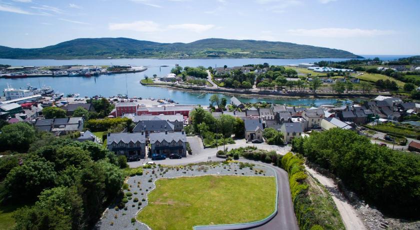
Top hotels near Beara way
3 Reviews
9.5
$132.43 per nightSelect
Know more about Beara way
Beara wayThe Beara Way is an stunning long distance walking trail in Counties Cork and Kerry. It is a 206-kilometre long circular trail around the Beara Peninsula that begins and ends in Glengarriff, County Cork, also passing through parts of County Kerry.It is typically completed in nine days. It is designated as a National Waymarked Trail by the National Trails Office of the Irish Sports Council and is managed by the Beara Tourism and Development Association.