18 Attractions to Explore Near Inis Cealtra
Top Activities Near Inis Cealtra
Filter By Date
//
Sort By

Attractions & Activities Near You
Checkout attractions and activities near your current locationAll attractions near Inis Cealtra
Graves of the LeinstermenThe Graves of the Leinstermen has arguably the most evocative name of all the sites in the Adopt a Monument Scheme. Mystery surrounds this megalithic monument on the slopes of the Arra Mountains overlooking Lough Derg in Co. Tipperary. The monument, however, is thought to date back to prehistory, with the general consensus being that it is some form of megalithic tomb.
TountinnaTountinna is the highest point on the Arra Mountains and forms part of the Lough Derg Way. A trip to the summit by foot offers panoramic views of Lough Derg and it’s also possible to drive to the summit taking a righthand turn just outside the historic town of Baliina on the Portroe road. There’s a picnic area at the top to take a seat and see how many counties you can see.
Lough Derg WayThe Lough Derg Way is a long-distance trail in Ireland. It follows a mix of riverbank, canal bank, forest track, old roadway and minor roads. Along the way the route passes through the hamlet of Clonlara, the village of O’Briensbridge and the ancient town of Killaloe, which was once home of the famous 11th century High King of Ireland, Brian Boru. Killaloe is a heritage town, and interested walkers will want to linger at St Flannan’s Cathedral with its early Christian oratory.
Arra MountainsThe Arra Mountains or Arra Hills are situated in County Tipperary in Ireland, between the towns of Nenagh and Ballina, south east of Lough Derg and north of the M7 Motorway. The highest summit is Tountinna (Irish: Tonn Toinne) at 457m high. A good trekking destination and also it offers stunning views from here.
MoylussaMoylussa is a mountain in the Slieve Bernagh range in western Ireland, and the highest point in County Clare at 532 metres. There are a number of routes to the summit; one of the most popular ascents starts from the forest car park at Ballycuggaran, Ogonnelloe. The route passes through one of the conifer plantations that have been created on the shoulder of the mountain and other nearby hills by Coillte, the state owned forestry company.
Dromineer CastleThis castle began as a 13th-century hall house and was later converted into a tower house in the 15th/16th century. It was built by the followers of Thomas Butler Esq. in the 13th century. The hall house was originally only two storeys high, but two additional storeys were later added, and vaults added to the ground floor. A base batter is present and can be attributed to the earlier structure.
Nenagh RiverThe Nenagh River rises in the Silvermine Mountains in County Tipperary, Ireland. It flows east of Nenagh and into Lough Derg just north of Dromineer. The river, and its tributary the Ollatrim river, is popular for angling, it holds a stock of wild salmon and trout. There are also coarse fish particularly near the mouth of the river during spawning times.
Tullaun CastleTullaun Castle is a Gaelic four-storey tower house that is believed to have been built in the mid 1500s.The Castle dates back to 1570 when Dermot Kennedy was the first recorded owner. According to current owner Sonja Bergin – “it is a Kennedy Castle in Kennedy Country“! John, William & Rory Kennedy were the last Kennedy owners in the 1640’s. Tullaun apparently means grassy knoll but enough of that sort of talk.
Lough GraneyLough Graney is a little romantic lake to the north-west of the town land of Clonusker. It nestles among the glens and valleys of Cahir. The lake's outlet is the short River Graney, which flows through Lough O'Grady and past the town of Scarriff into the west side of Lough Derg.
East Clare WayThe East Clare Way is a long-distance trail in County Clare, Ireland. It is a 180-kilometre long circular route that begins and ends in Killaloe. It is typically completed in eight days. It is designated as a National Waymarked Trail by the National Trails Office of the Irish Sports Council and is managed by East & Mid Clare Way Limited and the East Clare Way Committee.
Nenagh Heritage CentreThe Nenagh Heritage Centre is located in two stone Georgian buildings, built in 1840-1842 as the Governor's House and Gatehouse of an extensive Gaol complex for North Tipperary, which held thousands of prisoner's until its closure in 1887. It historically housed those sentenced to death by public hanging. Between 1842 and 1858, 17 Tipperary men were executed here. After its closure, the property was taken over by the Sisters of Mercy for educational purposes.
Nenagh CastleNenagh Castle was built by Theobald Walter and is the oldest building, and its construction in the 13th century laid the foundation for the development of the town. Built from limestone Nenagh Castle measures fifty-five feet in external diameter at the base and rises to a height of one hundred feet. The Castle features four storeys and thanks to a recent renovation this wonderful landmark now represents the town’s premier tourist attraction.
Keeper HillKeeper Hill is situated in the Slieve Felim mountain range in North Tipperary, just 15km east of Limerick City. The mountain is about 15 km east of Limerick City. Keeper Hill is the highest mountain in the Silvermines and the 58th highest in Ireland. There is a stone circle in Bauraglanna townland on the northeastern slopes, known as Firbrega. There is a looped walk around the lower shoulders of Keeper Hill, to which the ‘hardy’ walker can add the ‘trek’ to the summit.
Portumna Forest ParkA majestic forest park which covers almost 600 hectares. It is mainly coniferous but also contains a wide variety of broadleaved trees, both native and exotic. There is an old abbey, now under the care of the Office of Public Works, within the Park which dates back to the 15th century. The castle nearby, on which considerable restoration work has been carried out by the OPW, dates back to the 17th century and was the seat of the Earl of Clanrickarde.
Portumna Castle & GardensPortumna Castle is a semi-fortified house in Portumna, County Galway, Ireland. It was built in the early 17th century by the 4th Earl of Clanricarde, Richard Burke. The castle is a unique example of the transitional Irish architecture of the early 1600s. Its bold design combines elements of medieval and Renaissance style that complement each other perfectly.
Lough CutraLough Cutra is a lake in County Galway, Ireland. It is the site of a Special Area of Conservation. There are so many things to see and do in this area and also attracts tourists by its natural beauty.
CraggaunowenCraggaunowen is a 16th-century castle and an archaeological open-air museum in County Clare, Ireland. It was built around 1550 by John MacSioda MacNamara, a descendant of Sioda MacNamara, who built Knappogue Castle in 1467. The open-air museum was started by John Hunt. It features reconstructions of ancient Irish architecture, including a dolmen, a crannog, and the currach boat used in Tim Severins recreation of "The Voyage of St. Brendan the Abbot".
Mountshannon HouseMountshannon House was a large mansion in Lisnagry, near Castleconnell, County Limerick, built in the mid-18th century. Erected on a 900 acre estate of the best of arable land. At the time half of the domain was covered in trees. The estate and house were serviced from the working area where there was quite a number of buildings including servants' quarters, stewards houses, stables, coach houses, laundry, its own gas making and so more.
Map of attractions near Inis Cealtra
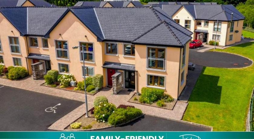
Top hotels near Inis Cealtra
48 Reviews
8.6
$351.48 per nightSelect
Know more about Inis Cealtra
Inis CealtraInis Cealtra is a 50-acre island on River Shannon and is located near Mountshannon in Co Clare. It’s unique, even in Ireland, in that there are monuments and artifacts here, dating back over 1000 years, that have survived in a wonderful state of preservation because of their secluded island location. Boat trips can be taken from the harbour at Mountshannon. It is conserved by the East Clare Heritage Centre.