18 Attractions to Explore Near Mount Capanne
Top Activities Near Mount Capanne
Filter By Date
//
Sort By

Attractions & Activities Near You
Checkout attractions and activities near your current locationAll attractions near Mount Capanne
Tuscan Archipelago National ParkThe Tuscan Archipelago National Park is the largest marine park in Europe. It includes the seven main islands of the Tuscan Archipelago, each unique in terms of beauty. It includes the 7 largest islands, bathed by the Tyrrhenian Sea and the Ligurian Sea, between the coasts of Tuscany and Corsica. Each island hides secrets and natural pearls that you can visit. It was one of the main tourist attractions in this area.
MontecristoThe island of Montecristo is located in the Tyrrhenian Sea and is part of the Tuscan Archipelago. Administratively it is included in the municipality of Portoferraio and therefore in the province of Livorno. The island is one of the 149 areas managed by the Carabinieri Command for the protection of biodiversity and parks, is part of the complex of natural reserves entrusted to the Follonica department, and is part of the Tuscan Archipelago National Park.
CavallinoMattoThe Cavallino Matto is an amusement park in Tuscany, located in Marina di Castagneto Carducci, in the province of Livorno. The park covers an area of 100,000 m². The Cavallino Matto was born in 1967 as a simple riding school, the playground was connected a few years later. Initially called Gulliver Park, it featured slides, swings, mini-golf, and fields for sports such as tennis and volleyball.
Étang de BigugliaThe Étang de Biguglia is a Corsican lagoon located south of Bastia, on the Bevinco river. It is the largest coastal pond on the island which covers 1,450 ha. The fort of Biguglia located north of the pond bears witness to the strong activities of the past. This pond has been exploited for many species of fish. A nine picnic spot and also you can have fish from this pond and also swimming is allowed here.
Genoese towers in CorsicaThe Genoese towers of Corsica are a series of coastal defenses built by the Republic of Genoa between the 15th and 18th centuries. There are around 70 towers still standing, and they are spread across the island. The towers were used as both lookout posts and defensive fortifications, and they were often manned by a small garrison of soldiers. In addition to their military function, the towers also served as a way for Genoa to assert its control over Corsica.
Col de TeghimeThe Col de Teghime is one of the main passes in Corsica. It offers a view of the two coasts of Corsica, with Bastia and the Tyrrhenian Sea to the east, Saint-Florent, the Desert of Agriates and the Mediterranean Sea to the west. A monument at the pass pays homage to the sacrifice of Moroccan goumiers in this battle and in the Liberation of Corsica. One of the nice location which was flourished with stunning views and natural beauty.
Moulin MatteiIt was one of the rare windmills that Corsica knew. But especially it is necessary to know that Mattei's name is more often associated with the mark of aperitif. From this mill, one can admire a remarkable sight on the sea as well as on the Centauri's picturesque port with a height of 365 meters and it is open to tourists. It was built at the end of the 18th century and had so many renovations later.
Monti dell' UccellinaThe Monti dell'Uccellina constitute a hilly group along the coastal strip of the Grosseto Maremma that divides the Ombrone plain to the north from the Albenga river plain to the south, in the territories of the municipalities of Grosseto, Magliano in Toscana and Orbetello. The whole area of the Uccellina Mountains is included within the Maremma Natural Park; the coast is high and rocky, except for the suggestive Cala di Forno which opens to the mistral winds.
Maremma Regional ParkThe Maremma Regional Park spreads across the hills of the Uccellina, a sinuous chain of hills parallel to the coast and covered with Meditteranean scrub. There are wide open spaces with lots of green, as well as many farmhouses that offer local Tuscan products and a place to stay and enjoy your leisure times. The park covers 9,000 hectares of open land around its boundaries. It is one of the paradises in Tuscany.
GorgonaOne of the beautiful islands in the Tuscan Archipelago, a group of islands off the west coast of Italy. There are 2 main islands and 2 tiny rocky keys. The main island of Gorgona is around 26 sq km in area. There are no permanent dwellers on the island. The island is covered with tropical forest, which includes 46 species of reptile, 18 of these snakes, bats, sloths, monkeys, tortoises, as well as the abundant marine life in its waters which can be seen snorkeling from the beach or diving.
Plage du LotuThe Beach Loto Note is a beach north of the coast of Agriates Desert in Corsica, located between Punta di Ravijola and Punta Cavallata, bathed by the Mediterranean Sea. The beach is shared for half between the municipalities of Santo-Pietro-di-Tenda to the west and Saint-Florent to the east. Loto beach is accessible by sea and, on foot from Saint-Florent, by the customs trail which runs along the entire coast of the Agriates desert.
Plage de SalecciaThe beach of Saleccia is located in Corsica , in the Agriates Desert , territory of which the origin of the name refers to "fertile agricultural land" 1 . The beach is considered one of the most beautiful on the island. The beach of Saleccia is a long strip of fine white sand that stretches for 1,200 m.
BravoneThe Bravona is a small French coastal river that flows in Haute-Corse and empties into the Tyrrhenian Sea. The lighthouse is still active and is fully automated and controlled by the Marine Nationale in Bastia. It was one of a series of coastal defenses constructed by the Republic of Genoa between 1530 and 1620 to protect against attacks by Barbary pirates.
Monte San PetroneThe Monte San Petrone is a mountain located in the department of Haute-Corse. The slopes of this schist massif are covered with chestnut trees returned to the state of the forest, which earned it the name of Castagniccia. One of the nice trekking destination and also a place which is blessed with natural beauty.
Désert des AgriatesThe desert of Agriates or the Agriates is a territory of Corsica shared between the micro-regions of Balagne 1 to the west and Nebbio. The only inhabited place of Les Agriates is the scattered hamlet of Casta . Some tourist guides present it as the only desert in Western Europe. This wild and untamed little desert sums up the beauty of Corsica. There are among the most beautiful beaches on the island, incredible scenery, and a preserved scrubland.
Terrazza MascagniThe Mascagni Terrace is one of the most elegant and evocative places in Livorno and is located on the seafront on the edge of Viale Italia. The original nucleus was built starting from the 1920s, but the terrace was considerably extended immediately after the war when it was named after the Livorno composer Pietro Mascagni. Severely damaged over the years by violent storm surges and neglect, at the end of the nineties, the terrace was completely restored
Abbey of San GalganoSan Galgano Abbey was built in the early 13th century and is a Cistercian abbey that lies in the municipality of Chiusdino. The place is rich in history and is reminiscent of the medieval times during which it was built. It was a Romanesque church that was a jewel in its time but now lies in ruins. With its architecture and design, it can easily be deduced that it used to be magnificent during its Gothic times. Nearby are the chapel or Eremo or Rotonda di Montesiepi, the tomb of Saint Galgano, a
Plage de l'OstriconiThe Ostriconi is a small French coastal river that flows in the north of the department of Haute-Corse in the Corsica region and which empties into the Mediterranean Sea. One of the nice place to spend some leisure time and It flows from the southeast to the northwest, creating a valley called Paesi d'Ostriconi, located between the micro-regions of Nebbio and Giussani .
Map of attractions near Mount Capanne
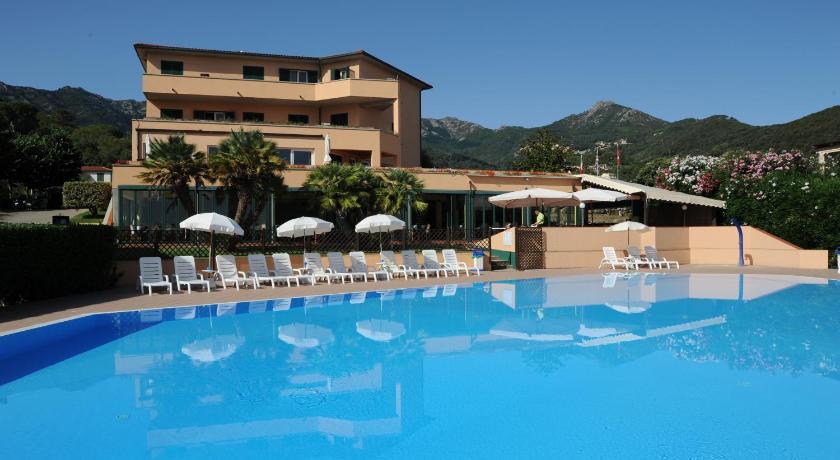
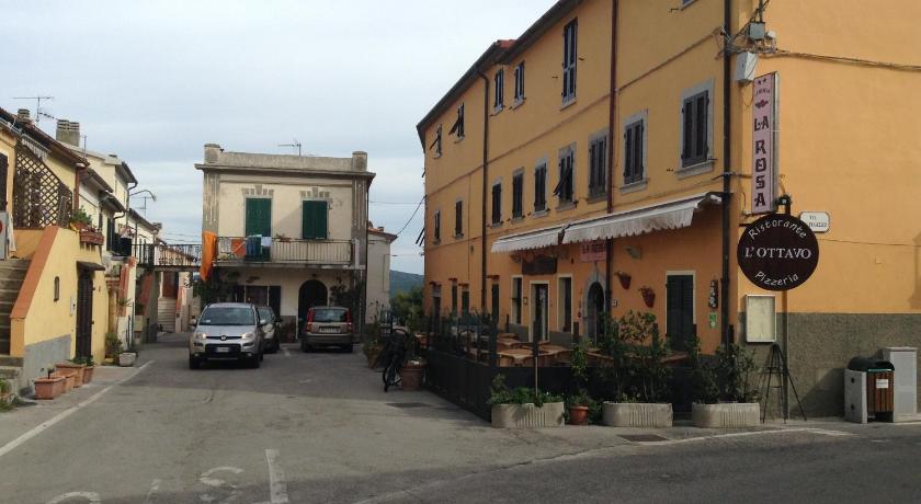
Top hotels near Mount Capanne
Know more about Mount Capanne
Mount CapanneThe Monte Capanne is the highest peak of the ' island of Elba and the whole province of Livorno. Located in the western part of the island, it reaches a height of 1019 meters above sea level. Its summit can be reached in just 18 minutes via a cable car that leaves from Marciana . The Pomonte Valley, the largest valley on the island of Elba, departs from the summit.